Approximate Location Map
Large Map »
Latitude: 51.6494 / 51°38'57"N
Longitude: -2.6911 / 2°41'28"W
OS Eastings: 352277
OS Northings: 194733
OS Grid: ST522947
Mapcode National: GBR JL.79RM
Mapcode Global: VH87M.9SNZ
Plus Code: 9C3VJ8X5+PG
Entry Name: Milestone set in the Boundary Wall of Chepstow Racecourse (Piercefield Park)
Listing Date: 14 February 2001
Last Amended: 14 February 2001
Grade: II
Source: Cadw
Source ID: 24761
Building Class: Transport
ID on this website: 300024761
Location: Set into the west boundary wall of Chepstow Racecourse (Piercefield Park) about 250m north of the junction of the A466 and the B4293.
County: Monmouthshire
Town: Chepstow
Community: St. Arvans
Community: Chepstow
Locality: Piercefield Park
Built-Up Area: Chepstow
Traditional County: Monmouthshire
Tagged with: Milestone
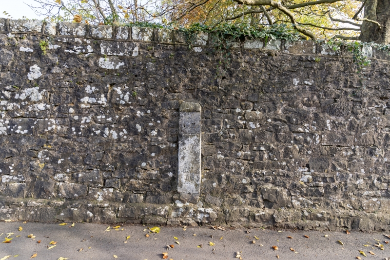
This milestone was erected as a part of the Chepstow to Abergavenny turnpike which was built in 1760 following theTurnpike Act of 1754. The road was built jointly by the trustees of both towns but the south end would have been in the care of the Chepstow Trust. The section between Crossways Green and St Arvans village seems to have been initiated by Valentine Morris to move the existing public road further away from his house. The milestone was presumably set into the boundary wall of Piercefield Park when that was constructed in 1794. In 1829 it became a part of the more important Wye Valley Turnpike between Chepstow and Monmouth. The trusts were wound up in 1873 and responsibility was passed to the Chepstow Highways Board and later to Monmouthshire County Council.
A milestone which is set into the boundary wall of Chepstow Racecourse (Piercefield Park). It is a cast iron plate set into a larger white stone, with relief lettering :
TO CHEPSTOW 1 MILE.
Included as a late C18 turnpike milestone on the A466 Wye Valley road which retains a number of others of different dates as well as the turnpike lodge.
External links are from the relevant listing authority and, where applicable, Wikidata. Wikidata IDs may be related buildings as well as this specific building. If you want to add or update a link, you will need to do so by editing the Wikidata entry.


Other nearby listed buildings
