Approximate Location Map
Large Map »
Latitude: 51.7556 / 51°45'20"N
Longitude: -2.6762 / 2°40'34"W
OS Eastings: 353424
OS Northings: 206537
OS Grid: SO534065
Mapcode National: GBR JM.0MJJ
Mapcode Global: VH877.K4LH
Plus Code: 9C3VQ84F+6G
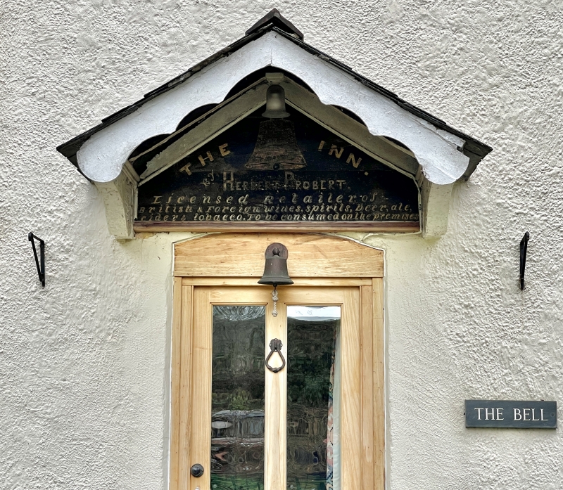
Entry Name: The Bell
Listing Date: 28 February 2001
Last Amended: 19 December 2001
Grade: II
Source: Cadw
Source ID: 24921
Building Class: Domestic
ID on this website: 300024921
Location: On the south side of the road towards the eastern end of Whitebrook valley and about 100m east of the Church of the Holy Trinity.
County: Monmouthshire
Town: Monmouth
Community: Trellech United (Tryleg Unedig)
Community: Trellech United
Locality: Whitebrook
Traditional County: Monmouthshire
Tagged with: Pub Historic house
A small late C18/early C19 house which became the local beer house and remained a public house until 1962. It is of interest as part of the history of the locality and a well preserved house not directly associated with the paper industry, but part of the service industry to it.
A small double fronted double depth house with rendered walls, presumably over the local rubble stone, and with a Welsh slate roof. The main elevation has a central panelled door with a hood on brackets. This is flanked by 6 over 6 sashes in elliptical heads, two more of the same on the first floor and 6-pane windows on the second floor hard under the eaves. Plain roof with a stack on the left hand gable, a second stack to rear range. The rear elevation has two 6 over 6 sashes, the gable walls are blind.
Interior not available for inspection at resurvey. The ground floor is of open plan with a central staircase.
Included as a well preserved late C18/early C19 public house in an area of historic rural industry.
External links are from the relevant listing authority and, where applicable, Wikidata. Wikidata IDs may be related buildings as well as this specific building. If you want to add or update a link, you will need to do so by editing the Wikidata entry.


Other nearby listed buildings
