Approximate Location Map
Large Map »
Latitude: 51.7563 / 51°45'22"N
Longitude: -2.6782 / 2°40'41"W
OS Eastings: 353283
OS Northings: 206618
OS Grid: SO532066
Mapcode National: GBR JM.0F20
Mapcode Global: VH877.J3HY
Plus Code: 9C3VQ84C+GP
Entry Name: Cider Mill at Fern Bank
Listing Date: 28 February 2001
Last Amended: 28 February 2001
Grade: II
Source: Cadw
Source ID: 24922
Building Class: Institutional
ID on this website: 300024922
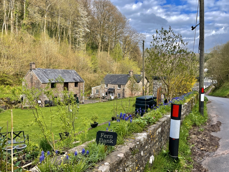
Location: On the north side of the Whitebrook valley road and about 150m west of the Church of the Holy Trinity.
County: Monmouthshire
Town: Monmouth
Community: Trellech United (Tryleg Unedig)
Community: Trellech United
Locality: Whitebrook
Traditional County: Monmouthshire
Tagged with: Cider mill
A probably early/mid C19 cider mill in very good and unaltered condition, which has additional interest as having been part of the youth hostel during WWII. It is marked on the1881 OS 25" map.
The building is rectangular in plan and is very neatly constructed of local red sandstone randomly cut and coursed but with neatly dressed quoins and features, Welsh slate roof. The main (south) elevation is of two storeys and has two windows. These are 2-light casements under large lintels on the ground floor and similar above, but topped by the eaves. Central stone stair leading to upper plank door. Plain roof with ridge tiles and dressed stone stack to the left gable. The left gable is blind. The right gable has the entrance to the cider house on the ground floor with plank door and 2-light casement to right, similar casement in the gable above. The rear elevation is blind and there is no indication of there having been any connection to a water wheel in the immediately adjacent leat.
The interior of the cider house has a pitched stone floor and the frame of the press is still in situ, the crusher is in the yard outside the door. Heavy beamed ceiling supporting the granary/apple store above. The upper room, from the very strong floor structure, appears to have been intended for a granary, but the windows and the chimney also a suggest a domestic use at some time or it could have been used as summer accommodation for itinerant workers. It was use as a youth hostel dormitory during WWII.
Included as a well preserved mid C19 cider mill.
External links are from the relevant listing authority and, where applicable, Wikidata. Wikidata IDs may be related buildings as well as this specific building. If you want to add or update a link, you will need to do so by editing the Wikidata entry.


Other nearby listed buildings
