Approximate Location Map
Large Map »
Latitude: 51.6795 / 51°40'46"N
Longitude: -3.1861 / 3°11'9"W
OS Eastings: 318090
OS Northings: 198524
OS Grid: ST180985
Mapcode National: GBR HX.5K8T
Mapcode Global: VH6DF.Q1HT
Plus Code: 9C3RMRH7+QH
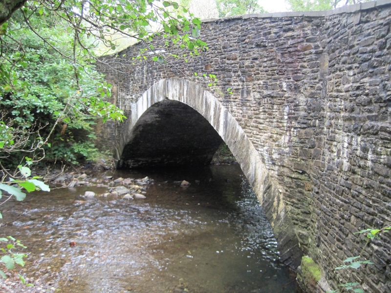
Entry Name: Pont Syr Dafydd (partly in Penmaen Community)
Listing Date: 23 March 1999
Last Amended: 25 May 2001
Grade: II
Source: Cadw
Source ID: 25235
Building Class: Communications
ID on this website: 300025235
Location: At the foot of Rhiw Syr Dafydd Hill, an exceptionally steep road crossing the Sirhowy valley, and SE of the PH at Rock on the Newport Road.
County: Caerphilly
Town: Blackwood
Community: Blackwood (Coed Duon)
Community: Argoed
Locality: Rock
Traditional County: Monmouthshire
Tagged with: Bridge
See Record Number 18724 in Penmaen Community for full description of this bridge.
External links are from the relevant listing authority and, where applicable, Wikidata. Wikidata IDs may be related buildings as well as this specific building. If you want to add or update a link, you will need to do so by editing the Wikidata entry.


Other nearby listed buildings
