Approximate Location Map
Large Map »
Latitude: 53.3254 / 53°19'31"N
Longitude: -3.8308 / 3°49'50"W
OS Eastings: 278161
OS Northings: 382503
OS Grid: SH781825
Mapcode National: GBR 1YPZ.FN
Mapcode Global: WH64Y.4P21
Plus Code: 9C5R85G9+5M
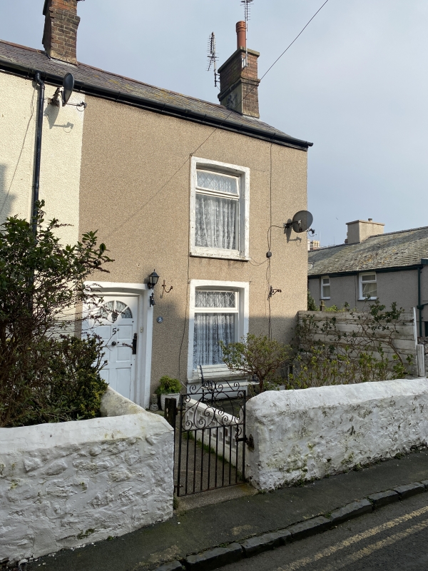
Entry Name: 5, Ty-Isa Road, including front garden wall, Llandudno, LL30 2PL
Listing Date: 16 March 1976
Last Amended: 6 June 2001
Grade: II
Source: Cadw
Source ID: 25446
Building Class: Domestic
ID on this website: 300025446
Location: About 20m N of junction with Trevor Street.
County: Conwy
Community: Llandudno
Community: Llandudno
Built-Up Area: Llandudno
Traditional County: Caernarfonshire
Tagged with: Building
1850s or 1860s.
Top hung sash window to each floor in right hand bay and doorway to left hand. Colourwashed stone rubble front garden wall.
One of a group of smaller C19 houses on the lane between The Parade and Mostyn Street. Group value with each other, and buildings in adjacent Trevor Street.
External links are from the relevant listing authority and, where applicable, Wikidata. Wikidata IDs may be related buildings as well as this specific building. If you want to add or update a link, you will need to do so by editing the Wikidata entry.


Other nearby listed buildings
