Approximate Location Map
Large Map »
Latitude: 53.3246 / 53°19'28"N
Longitude: -3.8299 / 3°49'47"W
OS Eastings: 278215
OS Northings: 382414
OS Grid: SH782824
Mapcode National: GBR 1YPZ.MY
Mapcode Global: WH64Y.4PHN
Plus Code: 9C5R85FC+R2
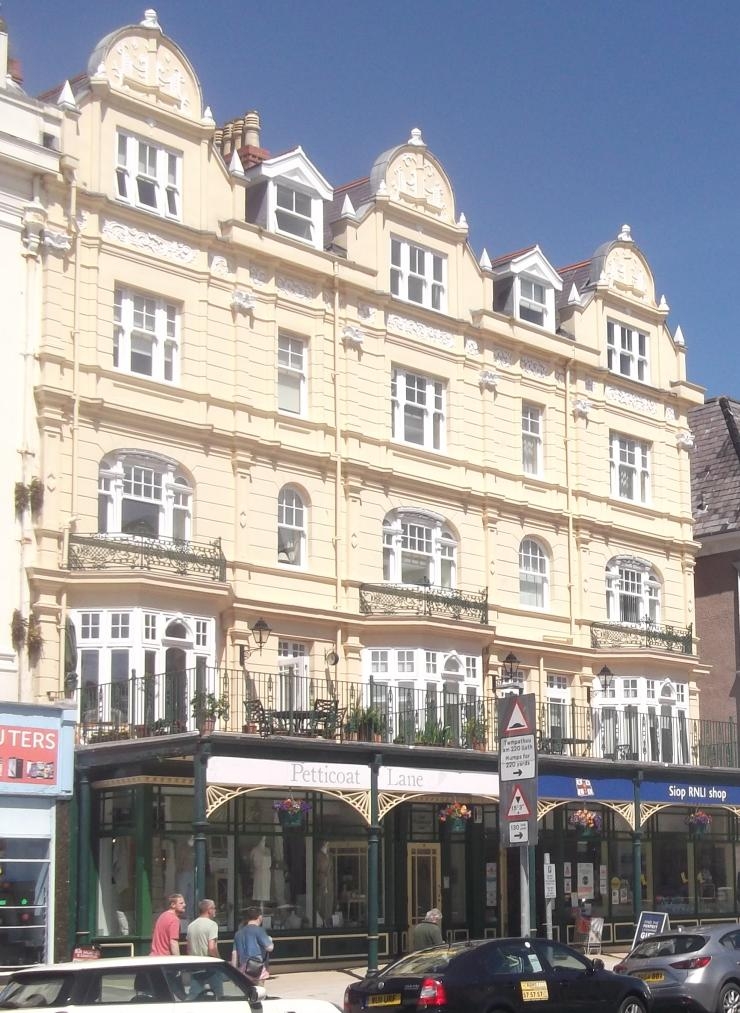
Entry Name: 6, St George's Place, Llandudno
Listing Date: 6 June 2001
Last Amended: 6 June 2001
Grade: II
Source: Cadw
Source ID: 25462
Building Class: Commercial
ID on this website: 300025462
Location: On corner with Ty Isa Road.
County: Conwy
Community: Llandudno
Community: Llandudno
Built-Up Area: Llandudno
Traditional County: Caernarfonshire
Tagged with: Building
For details see list description for 81 Mostyn Street.
External links are from the relevant listing authority and, where applicable, Wikidata. Wikidata IDs may be related buildings as well as this specific building. If you want to add or update a link, you will need to do so by editing the Wikidata entry.


Other nearby listed buildings
