Approximate Location Map
Large Map »
Latitude: 51.6002 / 51°36'0"N
Longitude: -3.0037 / 3°0'13"W
OS Eastings: 330581
OS Northings: 189517
OS Grid: ST305895
Mapcode National: GBR J5.BH5K
Mapcode Global: VH7BC.W1GM
Plus Code: 9C3RJX2W+3G
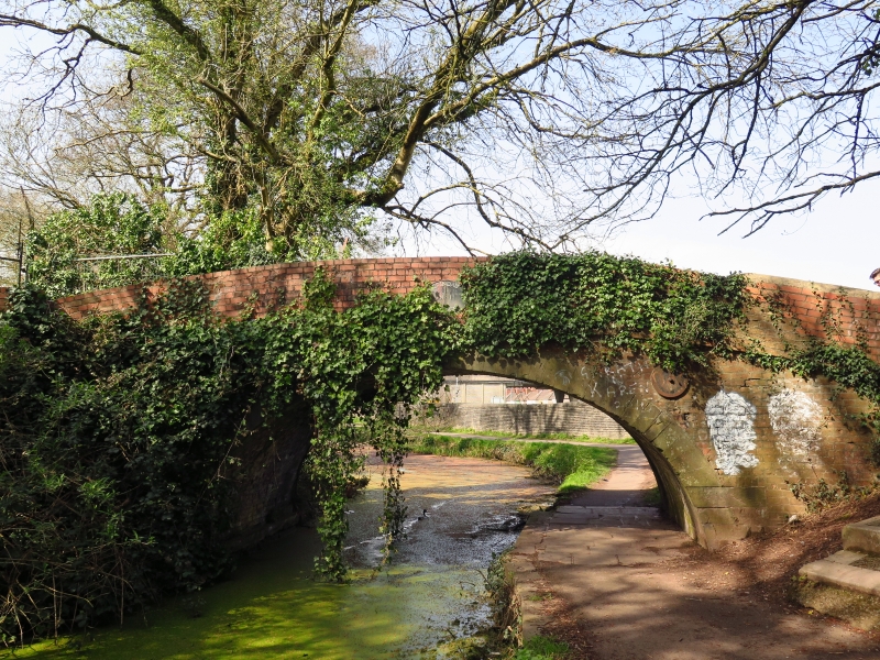
Entry Name: Crindau Bridge, Monmouthshire and Brecon Canal (partly in Allt yr yn community)
Listing Date: 14 September 1999
Last Amended: 28 August 2001
Grade: II
Source: Cadw
Source ID: 25733
Building Class: Transport
ID on this website: 300025733
Location: Located off the Malpas Road, immediately S of Junction 26 of the M4 motorway. Bridge carries track to allotments.
County: Newport
Town: Newport
Community: Shaftesbury
Community: Shaftesbury
Locality: Crindau
Built-Up Area: Newport
Traditional County: Monmouthshire
See record number 22332 in Allt yr yn community for full description of this bridge.
External links are from the relevant listing authority and, where applicable, Wikidata. Wikidata IDs may be related buildings as well as this specific building. If you want to add or update a link, you will need to do so by editing the Wikidata entry.


Other nearby listed buildings
