Approximate Location Map
Large Map »
Latitude: 51.7342 / 51°44'3"N
Longitude: -3.8495 / 3°50'58"W
OS Eastings: 272376
OS Northings: 205562
OS Grid: SN723055
Mapcode National: GBR H1.1SJG
Mapcode Global: VH4JS.7N8X
Plus Code: 9C3RP5M2+M5
Entry Name: Gate and gatepiers to Church of St Ciwg
Listing Date: 13 March 2003
Last Amended: 13 March 2003
Grade: II
Source: Cadw
Source ID: 80990
Building Class: Religious, Ritual and Funerary
ID on this website: 300080990
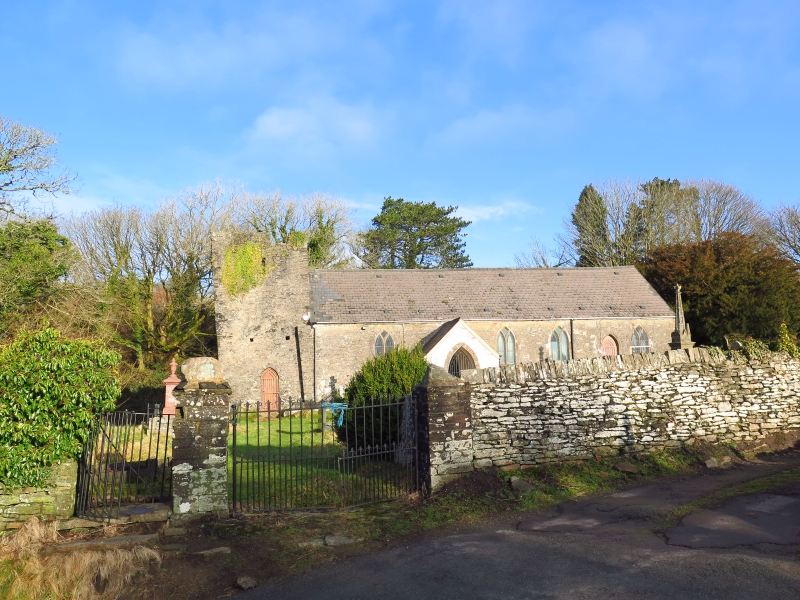
Location: Situated on the S side of the churchyard of the Church of Saint Ciwg.
County: Neath Port Talbot
Town: Swansea
Community: Pontardawe
Community: Pontardawe
Locality: Llangiwg
Traditional County: Glamorgan
Tagged with: Gate
Gatepiers and gates to churchyard, probably earlier C19.
Pedestrian gate with iron kissing gate and paired iron main gates with dog bars and fleur-de-lys finials, between two piers of squared tooled stone and third pier built into end of rubble wall, all three with plain caps and large boulder finials.
Included for group value with the parish church.
External links are from the relevant listing authority and, where applicable, Wikidata. Wikidata IDs may be related buildings as well as this specific building. If you want to add or update a link, you will need to do so by editing the Wikidata entry.


Other nearby listed buildings
