Approximate Location Map
Large Map »
Latitude: 51.7028 / 51°42'10"N
Longitude: -2.9007 / 2°54'2"W
OS Eastings: 337850
OS Northings: 200834
OS Grid: SO378008
Mapcode National: GBR J9.3YY8
Mapcode Global: VH79V.NGVH
Plus Code: 9C3VP33X+4P
Entry Name: Berry Tomb in St Mary's Churchyard
Listing Date: 30 April 2004
Last Amended: 30 April 2004
Grade: II
Source: Cadw
Source ID: 82757
ID on this website: 300082757
Location: On N side of path in churchyard.
County: Monmouthshire
Town: Usk
Community: Usk (Brynbuga)
Community: Usk
Built-Up Area: Usk
Traditional County: Monmouthshire
Tagged with: Tomb
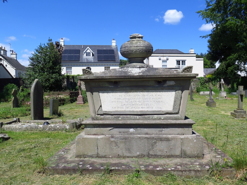
Early C19.
Chest tomb in Grecian style. Rectangular chest with corners sloping outwards; on plinth. Capstone with acroteria supports heavy elliptical urn. Inscription in memory of Edward Berry of Llancayo House, who died in 1818.
Strongly designed early C19 chest tomb. group value with adjacent listed church and churchyard walls.
External links are from the relevant listing authority and, where applicable, Wikidata. Wikidata IDs may be related buildings as well as this specific building. If you want to add or update a link, you will need to do so by editing the Wikidata entry.


Other nearby listed buildings
