Approximate Location Map
Large Map »
Latitude: 52.4106 / 52°24'38"N
Longitude: -3.9332 / 3°55'59"W
OS Eastings: 268604
OS Northings: 280932
OS Grid: SN686809
Mapcode National: GBR 8Z.P67Y
Mapcode Global: VH4FF.SN1X
Plus Code: 9C4RC368+6P
Entry Name: Milestone SW of Goginan
Listing Date: 26 May 2004
Last Amended: 26 May 2004
Grade: II
Source: Cadw
Source ID: 82810
Building Class: Transport
ID on this website: 300082810
Location: Situated about 300m SW of former school at Goginan.
County: Ceredigion
Town: Aberystwyth
Community: Melindwr
Community: Melindwr
Locality: Goginan
Traditional County: Cardiganshire
Tagged with: Milestone
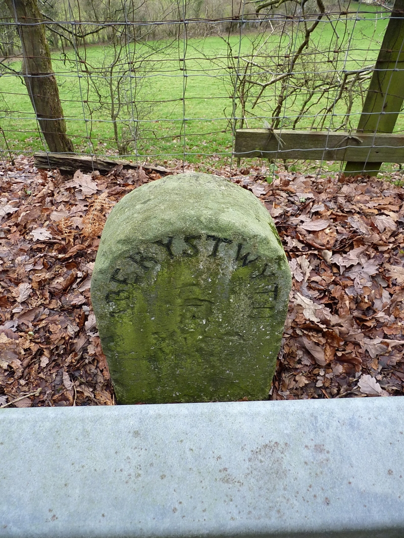
C19 milestone on Aberystwyth to Llanurig turnpike road. Turnpike trust formed 1770, new road laid out 1812 through Goginan and Ponterwyd replacing old road, now A 4120. One of a series of matching milestones along the A44.
Milestone, whitewashed stone with 'Aberystwyth 7 Miles' inscribed in capitals, the place name following arch of milestone.
Included for transport historical interest.
External links are from the relevant listing authority and, where applicable, Wikidata. Wikidata IDs may be related buildings as well as this specific building. If you want to add or update a link, you will need to do so by editing the Wikidata entry.


Other nearby listed buildings
