Approximate Location Map
Large Map »
Latitude: 51.6759 / 51°40'33"N
Longitude: -4.9173 / 4°55'2"W
OS Eastings: 198390
OS Northings: 201492
OS Grid: SM983014
Mapcode National: GBR G8.WDWS
Mapcode Global: VH1S6.Q48K
Plus Code: 9C3QM3GM+93
Entry Name: Castle Inn
Listing Date: 29 July 2005
Last Amended: 29 July 2005
Grade: II
Source: Cadw
Source ID: 84965
Building Class: Commercial
Also known as: The Castle Inn, Pembroke
ID on this website: 300084965
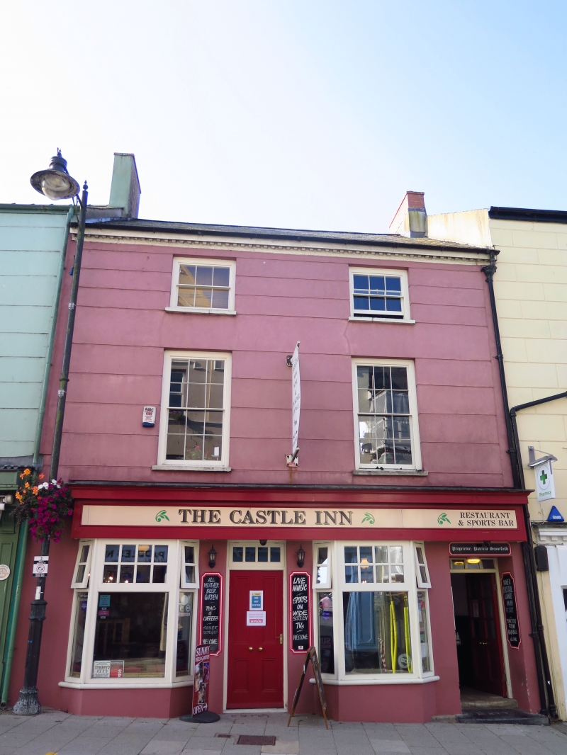
Late Georgian town house, later commercial premises, the Castle Inn since c. 1952. It replaced the Pembroke Steam Brewery run from 1870s by G. Llewellyn Griffiths, taken over c. 1914-18 by James Williams and brewing ceased in 1920s. There was a small taproom that continued to the mid C20 as the Spirit Vaults.
Inn, terraced front in painted stucco with slate close-eaved roof and brick end stacks. Brick dentilled eaves, lower than Nos. 15 and 19 adjoining. Three storeys, two-window range with horizontal channelling to upper floors and outer thin pilasters, ground floor modernised. Two hornless 6-pane top floor sashes, two hornless 12-pane first floor sashes. Ground floor has door to extreme right (to former through passage) and later C20 inn front to left with door between two projecting canted bays with overall fascia. Overlight over door, small panes to projecting bays over rubble stone bases.
Various rear additions with passage on W side.
Interior altered, long and narrow with stairs behind front left room.
Included notwithstanding modern alterations to ground floor as a late Georgian terraced house front retaining original upper windows.
External links are from the relevant listing authority and, where applicable, Wikidata. Wikidata IDs may be related buildings as well as this specific building. If you want to add or update a link, you will need to do so by editing the Wikidata entry.


Other nearby listed buildings
