Approximate Location Map
Large Map »
Latitude: 51.8119 / 51°48'42"N
Longitude: -2.7123 / 2°42'44"W
OS Eastings: 350990
OS Northings: 212820
OS Grid: SO509128
Mapcode National: GBR FL.X1TG
Mapcode Global: VH86T.XQZD
Plus Code: 9C3VR76Q+P3
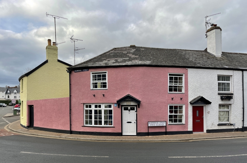
Entry Name: d, Almshouse Street
Listing Date: 10 August 2005
Last Amended: 10 August 2005
Grade: II
Source: Cadw
Source ID: 85181
ID on this website: 300085181
Location: In a group in between the town centre and the River Wye.
County: Monmouthshire
Town: Monmouth
Community: Monmouth (Trefynwy)
Community: Monmouth
Built-Up Area: Monmouth
Traditional County: Monmouthshire
Tagged with: Architectural structure
Early to mid C19 and externally unaltered since.
Interior restructured in late C20 but retains very small rooms. Only No. 11 was seen at resurvey.
Included for its special architectural interest as part of an early C19 terrace of small scale houses.in the Monmouth town centre.
External links are from the relevant listing authority and, where applicable, Wikidata. Wikidata IDs may be related buildings as well as this specific building. If you want to add or update a link, you will need to do so by editing the Wikidata entry.


Other nearby listed buildings
