Approximate Location Map
Large Map »
Latitude: 51.946 / 51°56'45"N
Longitude: -3.3882 / 3°23'17"W
OS Eastings: 304677
OS Northings: 228412
OS Grid: SO046284
Mapcode National: GBR YP.MG6J
Mapcode Global: VH6BZ.7C41
Plus Code: 9C3RWJW6+CP
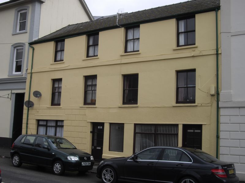
Entry Name: 33, The Watton
Listing Date: 16 December 1976
Last Amended: 4 November 2005
Grade: II
Source: Cadw
Source ID: 85664
ID on this website: 300085664
Location: Opposite entrance to Lansdowne Terrace.
County: Powys
Town: Brecon
Community: Brecon (Aberhonddu)
Community: Brecon
Built-Up Area: Brecon
Traditional County: Brecknockshire
Tagged with: Building
Probably mid C19, modernised later C20. Formerly ground floor had wooden doorcase to No.35 with plain pilasters; frieze and cornice on consoles, cornice continuing across windows and door in No.34, that is over two shop windows and shop doorway with similar casing of pilasters.
Included for Group Value with other listed buildings in The Watton.
External links are from the relevant listing authority and, where applicable, Wikidata. Wikidata IDs may be related buildings as well as this specific building. If you want to add or update a link, you will need to do so by editing the Wikidata entry.


Other nearby listed buildings
