Approximate Location Map
Large Map »
Latitude: 51.9437 / 51°56'37"N
Longitude: -3.3836 / 3°23'0"W
OS Eastings: 304994
OS Northings: 228151
OS Grid: SO049281
Mapcode National: GBR YP.MPCR
Mapcode Global: VH6BZ.9DLS
Plus Code: 9C3RWJV8+FH
Entry Name: 92, The Watton
Listing Date: 16 December 1976
Last Amended: 4 November 2005
Grade: II
Source: Cadw
Source ID: 85739
ID on this website: 300085739
Location: Opposite The Barracks.
County: Powys
Town: Brecon
Community: Brecon (Aberhonddu)
Community: Brecon
Built-Up Area: Brecon
Traditional County: Brecknockshire
Tagged with: Building
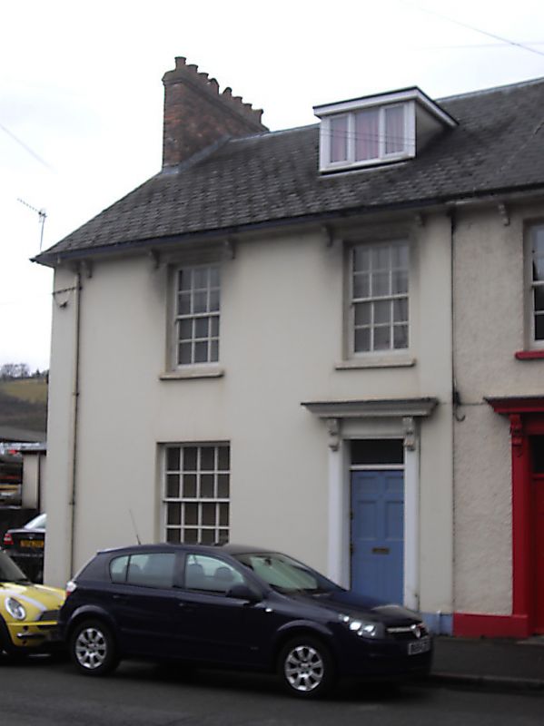
Circa mid C19.
No.91 is pebbledashed; No.92 is stuccoed. Each with two 12-pane horned sashes on first floor; on ground floor, a 16-pane sash window with horns in outer bay and, in inner bay, doorcase with pilasters and bracketed cornices; rectangular fanlight; six-panelled doors.
Modern dormer to No 92.
Early C19 row retaining much character. Group value with adjacent listed buildings in The Watton.
External links are from the relevant listing authority and, where applicable, Wikidata. Wikidata IDs may be related buildings as well as this specific building. If you want to add or update a link, you will need to do so by editing the Wikidata entry.


Other nearby listed buildings
