Approximate Location Map
Large Map »
Latitude: 52.0679 / 52°4'4"N
Longitude: -3.1808 / 3°10'50"W
OS Eastings: 319158
OS Northings: 241711
OS Grid: SO191417
Mapcode National: GBR YY.CZLN
Mapcode Global: VH6BH.T9B4
Plus Code: 9C4R3R99+4M
Entry Name: Former Mill
Listing Date: 27 October 2010
Last Amended: 27 October 2010
Grade: II
Source: Cadw
Source ID: 87620
Building Class: Industrial
ID on this website: 300087620
Location: In the centre of Llowes village adjacent to a minor road leading through the village to the north.
County: Powys
Community: Glasbury (Y Clas-ar-wy)
Community: Glasbury
Locality: Llowes
Traditional County: Radnorshire
Early C19 mill and cottage referred to as 'Mill and Pond' in the Schedule for the Tithe Map for Llowes of 1844 but not shown on the map. William Davies is mentioned as the miller in the 1891 census and it is probable that the mill fell out of use shortly afterwards as there is no mention of the mill in Kelly's directory of 1895. The mill cottage remained unoccupied and overgrown until the beginning of C21, when at inspection repair works were being undertaken to the mill and its assocated structures and the mill cottage.
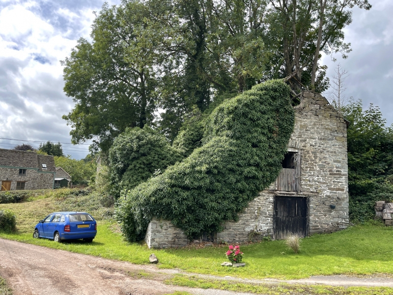
Water mill, rubble stone with stone slate roof (partially replaced). 3 storey gabled aligned NW-SE with single storey lean-to extension to the S.
Main elevation to SE with double door to ground floor, single loading door above and small window in the gable. Additional wide door to extension. SW elevation to lean-to has one shuttered window and one blocked door visible, the rest of the elevation is built into the rising ground with the former mill pond above and has two windows: leaded casement to the left, shuttered opening to the right. The NW elevation houses the wheel-shaft and the wheel-pit below, and has a shuttered opening to the first floor and a casement to the second floor. Also visible is the control mechanism for the sluice gate.
The main water wheel survives partially intact and is a mixed iron and timber overshot wheel of a rare "clasp-arm" construction. The iron was reportedly cast in Brecon.
Interior of mill of three floors with straight flight stairs against the SW wall of the main building, timber beams, joists and floorboards. Machinery of the standard type survives largely intact and comprises two pairs of under driven stones on the ground floor, along with flour dresser and small cleaner.
Listed for its special historic interest as a substantial surviving mill of the early C19, important for its central village location and for the degree of surviving machinery.
External links are from the relevant listing authority and, where applicable, Wikidata. Wikidata IDs may be related buildings as well as this specific building. If you want to add or update a link, you will need to do so by editing the Wikidata entry.


Other nearby listed buildings
