Approximate Location Map
Large Map »
Latitude: 52.7968 / 52°47'48"N
Longitude: -1.457 / 1°27'25"W
OS Eastings: 436709
OS Northings: 322280
OS Grid: SK367222
Mapcode National: GBR 6GF.QFJ
Mapcode Global: WHDHD.LYDR
Plus Code: 9C4WQGWV+P6
Entry Name: Deercote West of the Church of St Giles
Listing Date: 6 January 1987
Grade: II*
Source: Historic England
Source ID: 1031806
English Heritage Legacy ID: 82827
ID on this website: 101031806
Location: Calke, South Derbyshire, LE65
County: Derbyshire
District: South Derbyshire
Civil Parish: Calke
Traditional County: Derbyshire
Lieutenancy Area (Ceremonial County): Derbyshire
Church of England Parish: Ticknall St George
Church of England Diocese: Derby
Tagged with: Architectural structure
PARISH OF CALKE CALKE PARK
SK 32 SE
4/22
Deercote west of the
Church of St Giles
GV II*
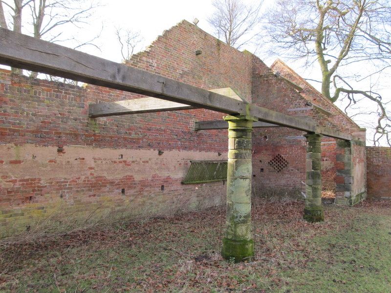
Deercote. Late C18. Red brick with sandstone dressings.
Originally plastered. Roof originally tiled but now in ruins,
some rafters remaining. Rectangular in plan, containing two
chambers open along one side and two closed chambers at either
end. Single storey. North and south elevations have a three-
bay arcade on circular ashlar columns with moulded capitals.
Angle quoins. Gable ends have partly blind Venetian windows in
the gables. The east gable end has below, two rectangular
openings, and the west gable end has three lozenge shaped blocks
of breathers. Fragmentary remains of walling attached to north
west relate to a demolished deer shelter.
Listing NGR: SK3670922280
External links are from the relevant listing authority and, where applicable, Wikidata. Wikidata IDs may be related buildings as well as this specific building. If you want to add or update a link, you will need to do so by editing the Wikidata entry.


Other nearby listed buildings
