Approximate Location Map
Large Map »
Latitude: 53.0285 / 53°1'42"N
Longitude: -1.4865 / 1°29'11"W
OS Eastings: 434537
OS Northings: 348036
OS Grid: SK345480
Mapcode National: GBR 6CP.30R
Mapcode Global: WHDGF.44FM
Plus Code: 9C5W2GH7+CC
Entry Name: Road archway and footbridge (includes offices forming south part of block in east side of archway)
Listing Date: 3 February 1966
Grade: II*
Source: Historic England
Source ID: 1087395
English Heritage Legacy ID: 78407
ID on this website: 101087395
Location: Scotches, Amber Valley, Derbyshire, DE56
County: Derbyshire
District: Amber Valley
Civil Parish: Belper
Built-Up Area: Belper
Traditional County: Derbyshire
Lieutenancy Area (Ceremonial County): Derbyshire
Church of England Parish: Belper Christ Church
Church of England Diocese: Derby
Tagged with: Architectural structure
This list entry was subject to a Minor Amendment on 30 March 2022 to update text and reformat to current standards
SK 3448 SE
1/53
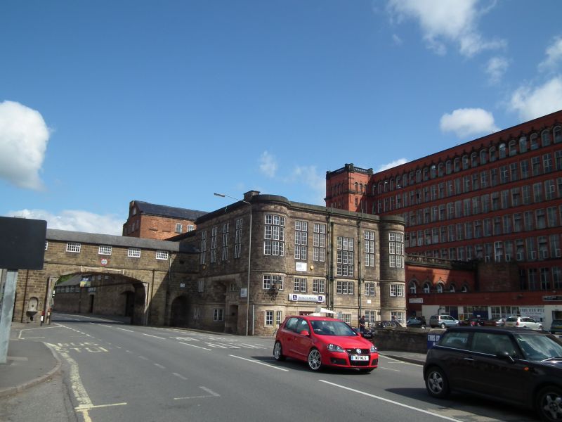
BRIDGE FOOT (East Side)
Road archway and footbridge (includes offices forming south part of block in east side of archway)
3.2.66.
II*
Late C18/early C19. (The road archway is said to date from the 1790s). Ashlar. Two storeys. Slate roof, large segmental arch for double carriageway across main road flanked by round headed pedestrian archways. The western wall dividing the archways contains a drinking fountain. First floor has five casements of three lights each with glazing bars and gun embrasures commanding the roadway and thought to have been installed in case of attack by the Luddites. West side advanced, three storeys with casements. Footbridge or gangway extends along roadside to north. Ashlar with segmental arch to road now blocked. Tall parapet on outer side, short on inner side.
Inter building to south of above three storeys, stone has round corner turrets to south corners, eaves band, plain frieze, cornice and blocking course, bands between storeys. Two and three light casements with mullions, upper windows with transoms. Top floor windows largest.
Listing NGR: SK3453748036
External links are from the relevant listing authority and, where applicable, Wikidata. Wikidata IDs may be related buildings as well as this specific building. If you want to add or update a link, you will need to do so by editing the Wikidata entry.


Other nearby listed buildings
