Approximate Location Map
Large Map »
Latitude: 52.0289 / 52°1'43"N
Longitude: -0.4948 / 0°29'41"W
OS Eastings: 503359
OS Northings: 237785
OS Grid: TL033377
Mapcode National: GBR G39.MQZ
Mapcode Global: VHFQT.C8RJ
Plus Code: 9C4X2GH4+G3
Entry Name: 46, Dunstable Street
Listing Date: 16 March 1972
Grade: II
Source: Historic England
Source ID: 1114453
English Heritage Legacy ID: 37379
ID on this website: 101114453
Location: Ampthill, Central Bedfordshire, MK45
County: Central Bedfordshire
Civil Parish: Ampthill
Built-Up Area: Ampthill
Traditional County: Bedfordshire
Lieutenancy Area (Ceremonial County): Bedfordshire
Church of England Parish: Ampthill
Church of England Diocese: St.Albans
Tagged with: Building
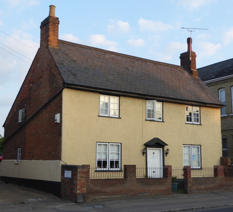
1.
774 DUNSTABLE STREET
(West Side)
No 46
TL 0338 1/78
II
2.
Late C18 remodelling of earlier structure; red brick on lower courses
of ironstone, the facade whitewashed pebbledash. 2 storeys. Deep eaves.
Steep slate roof. 3 windows (flush casements with glazing bars). 6- panel
door in simple reeded wooden case, with open pediment.
Listing NGR: TL0335937785
External links are from the relevant listing authority and, where applicable, Wikidata. Wikidata IDs may be related buildings as well as this specific building. If you want to add or update a link, you will need to do so by editing the Wikidata entry.


Other nearby listed buildings
