Approximate Location Map
Large Map »
Latitude: 53.2812 / 53°16'52"N
Longitude: -2.0916 / 2°5'29"W
OS Eastings: 393987
OS Northings: 376030
OS Grid: SJ939760
Mapcode National: GBR FZTH.ZH
Mapcode Global: WHBBH.VS5F
Plus Code: 9C5V7WJ5+F8
Entry Name: Kiln, 70 Metres North North West of Ivy House
Listing Date: 9 December 1983
Grade: II
Source: Historic England
Source ID: 1136462
English Heritage Legacy ID: 57970
ID on this website: 101136462
Location: Brookhouse, Cheshire East, Cheshire, SK10
County: Cheshire East
Civil Parish: Bollington
Traditional County: Cheshire
Lieutenancy Area (Ceremonial County): Cheshire
Church of England Parish: Bollington
Church of England Diocese: Chester
Tagged with: Kiln
SJ 97 NW BOLLINGTON WINDMILL LANE
(East Side)
2/53 Kiln, 70m NNW of Ivy
House.
II
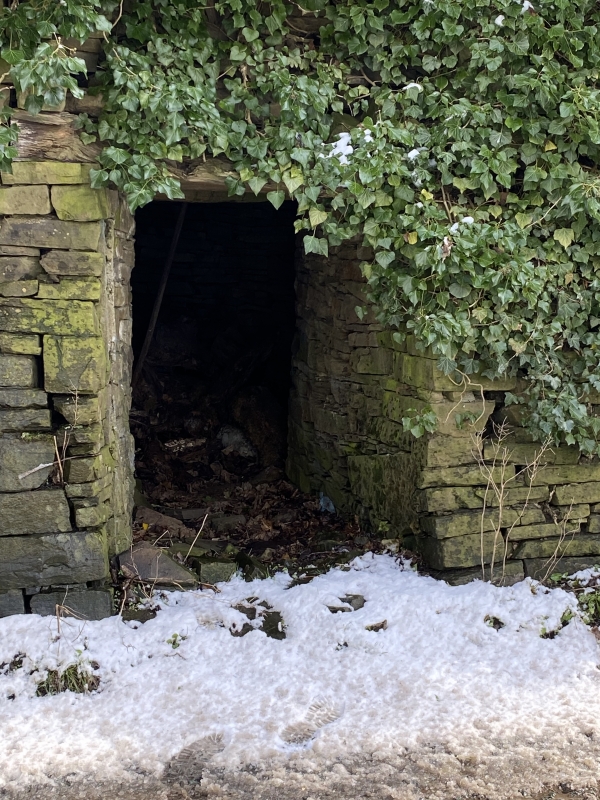
Potash or lime kiln: Probably late C18. Brown sandstone rubble. The
kiln is bottle-shaped and has a rectangular opening from the lane
through the drystone revetment wall. The kiln is set into the hill
and its top opening is covered with heavy flags.
Listing NGR: SJ9398776030
External links are from the relevant listing authority and, where applicable, Wikidata. Wikidata IDs may be related buildings as well as this specific building. If you want to add or update a link, you will need to do so by editing the Wikidata entry.


Other nearby listed buildings
