Approximate Location Map
Large Map »
Latitude: 53.0176 / 53°1'3"N
Longitude: -1.7353 / 1°44'7"W
OS Eastings: 417855
OS Northings: 346727
OS Grid: SK178467
Mapcode National: GBR 48Q.S43
Mapcode Global: WHCF5.9FX0
Plus Code: 9C5W2797+2V
Entry Name: Pump
Listing Date: 14 February 1974
Grade: II
Source: Historic England
Source ID: 1206308
English Heritage Legacy ID: 79782
ID on this website: 101206308
Location: Bellevue, Derbyshire Dales, Derbyshire, DE6
County: Derbyshire
District: Derbyshire Dales
Civil Parish: Ashbourne
Built-Up Area: Ashbourne
Traditional County: Derbyshire
Lieutenancy Area (Ceremonial County): Derbyshire
Church of England Parish: Ashbourne St Oswald
Church of England Diocese: Derby
Tagged with: Pump
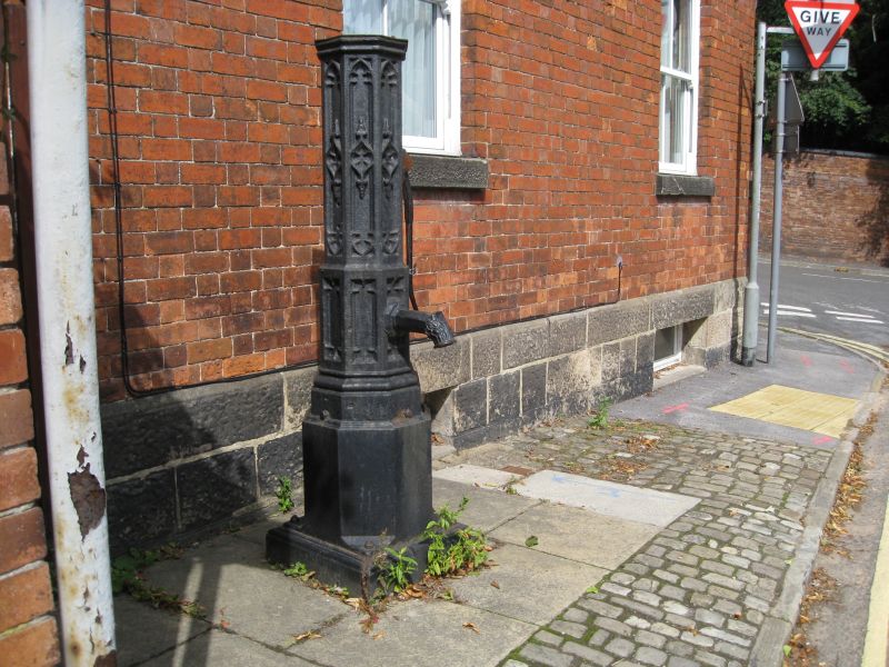
BELLE VUE ROAD
1.
783
(North-West Side)
Pump
SK 14 NE 1/86
II GV
2.
Early C19 cast iron pump with missing head. Moved here from the market place.
Decorated panels.
The pump forms a group with Dove House together with the garden wall and gazebo,
Dovehouse Green, and with Nos 24 and 26 Union Street.
Listing NGR: SK1785546727
External links are from the relevant listing authority and, where applicable, Wikidata. Wikidata IDs may be related buildings as well as this specific building. If you want to add or update a link, you will need to do so by editing the Wikidata entry.


Other nearby listed buildings
