Approximate Location Map
Large Map »
Latitude: 51.3572 / 51°21'25"N
Longitude: 0.2997 / 0°17'59"E
OS Eastings: 560221
OS Northings: 164520
OS Grid: TQ602645
Mapcode National: GBR Y6.886
Mapcode Global: VHHPG.44TY
Plus Code: 9F32974X+VV
Entry Name: Garden Wall to South East of Ash Manor Running Down to Road
Listing Date: 22 October 1982
Grade: II
Source: Historic England
Source ID: 1235107
English Heritage Legacy ID: 411266
ID on this website: 101235107
Location: Ash, Sevenoaks, Kent, TN15
County: Kent
District: Sevenoaks
Civil Parish: Ash-cum-Ridley
Traditional County: Kent
Lieutenancy Area (Ceremonial County): Kent
Church of England Parish: Ash St Peter and St Paul
Church of England Diocese: Rochester
Tagged with: Wall
ASH-CUM-RIDLEY CHURCH LANE
1.
5280
New Ash Green
Ash
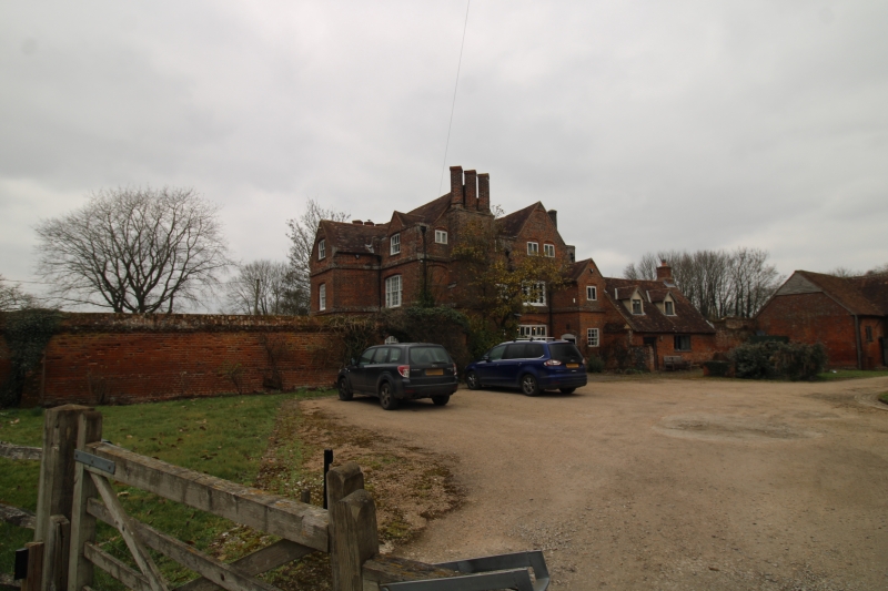
Garden wall to south-east
of Ash Manor running down
to road
TQ 66 SW 7/8
II GV
2.
Early C18. Red brick wall about 8 ft high, laid in English Bond. Brick coping
with cogged cornice.
Listing NGR: TQ6021464541
External links are from the relevant listing authority and, where applicable, Wikidata. Wikidata IDs may be related buildings as well as this specific building. If you want to add or update a link, you will need to do so by editing the Wikidata entry.


Other nearby listed buildings
