Approximate Location Map
Large Map »
Latitude: 54.4847 / 54°29'4"N
Longitude: -1.0898 / 1°5'23"W
OS Eastings: 459067
OS Northings: 510308
OS Grid: NZ590103
Mapcode National: GBR NJTL.V4
Mapcode Global: WHF8L.7J9T
Plus Code: 9C6WFWM6+V3
Entry Name: Boundary Stone East of Path to Captain Cook Monument
Listing Date: 8 May 1989
Grade: II
Source: Historic England
Source ID: 1315258
English Heritage Legacy ID: 332932
ID on this website: 101315258
Location: North Yorkshire, TS9
County: North Yorkshire
District: Hambleton
Civil Parish: Easby
Traditional County: Yorkshire
Lieutenancy Area (Ceremonial County): North Yorkshire
Church of England Parish: Great Ayton Christ Church
Church of England Diocese: York
Tagged with: Boundary marker
EASBY EASBY MOOR
NZ 51 SE NZ 591103
2/10
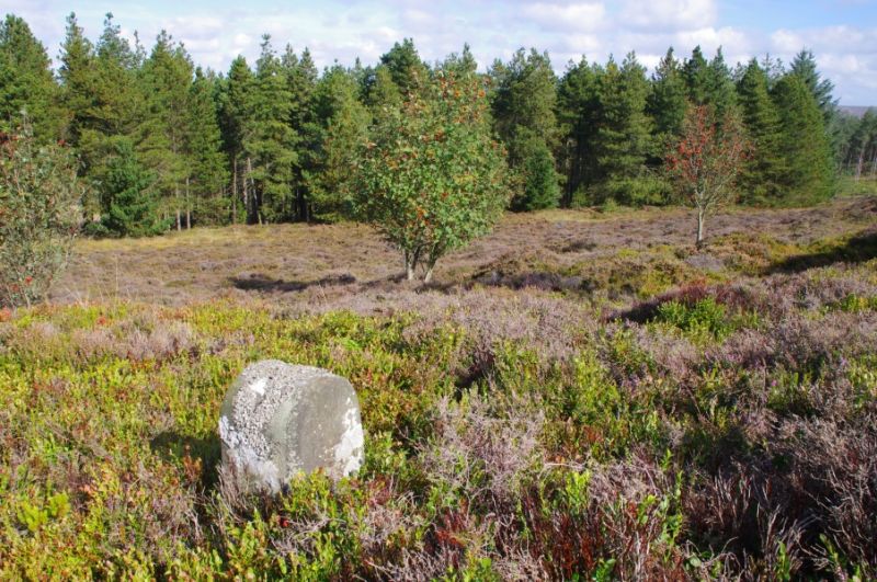
Boundary stone east of
path to Captain Cook
Monument
- II
Boundary stone marking boundary between parishes of Easby and Great Ayton.
Round-topped stone about 0.6 m high. On north face: T
H R
G A
14. On south face: E.
Listing NGR: NZ5907410312
External links are from the relevant listing authority and, where applicable, Wikidata. Wikidata IDs may be related buildings as well as this specific building. If you want to add or update a link, you will need to do so by editing the Wikidata entry.


Other nearby listed buildings
