Approximate Location Map
Large Map »
Latitude: 52.9522 / 52°57'7"N
Longitude: -0.9483 / 0°56'53"W
OS Eastings: 470758
OS Northings: 339938
OS Grid: SK707399
Mapcode National: GBR BLH.T8J
Mapcode Global: WHFJ6.D2P4
Plus Code: 9C4XX322+VM
Entry Name: Pair of Headstones 12 Metres South of Chancel at Church of St Mary and All Saints
Listing Date: 14 November 1986
Grade: II
Source: Historic England
Source ID: 1370109
English Heritage Legacy ID: 241753
ID on this website: 101370109
Location: St Mary's and All Saints Church, Bingham, Rushcliffe, Nottinghamshire, NG13
County: Nottinghamshire
District: Rushcliffe
Civil Parish: Bingham
Built-Up Area: Bingham
Traditional County: Nottinghamshire
Lieutenancy Area (Ceremonial County): Nottinghamshire
Church of England Parish: Bingham
Church of England Diocese: Southwell and Nottingham
Tagged with: Tombstone
BINGHAM CHURCH STREET
SK 7039
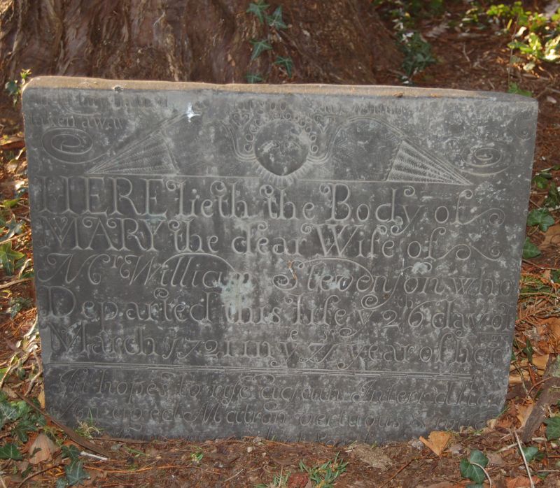
12/8 Pair of headstones
12M south of
chancel at Church
of St Mary and
All Saints
G.V. II
Pair of headstones. 1704 and 1721. Slate. That to left has
square head with incised angel flanked by hourglass and
crossbones. Inscription. To William Stevenson, 1704. Similar
stone to right has incised angel and verse inscription. To Mary
Stevenson, 1721
Listing NGR: SK7075839938
External links are from the relevant listing authority and, where applicable, Wikidata. Wikidata IDs may be related buildings as well as this specific building. If you want to add or update a link, you will need to do so by editing the Wikidata entry.


Other nearby listed buildings
