Approximate Location Map
Large Map »
Latitude: 51.6743 / 51°40'27"N
Longitude: -3.1837 / 3°11'1"W
OS Eastings: 318243
OS Northings: 197949
OS Grid: ST182979
Mapcode National: GBR HX.5RX7
Mapcode Global: VH6DF.R5RS
Plus Code: 9C3RMRF8+PG
Entry Name: Penmaen House
Listing Date: 19 January 1981
Last Amended: 23 March 1999
Grade: II
Source: Cadw
Source ID: 1888
Building Class: Domestic
Also known as: Penmaen House
ID on this website: 300001888
Location: Reached by a short track from the main thoroughfare between Penmaen and Pontllanfraith, part of the very small historic core of Penmaen and SW of the later Model Village development.
County: Caerphilly
Community: Penmaen
Community: Penmaen
Built-Up Area: Blackwood
Traditional County: Monmouthshire
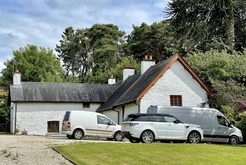
Probably C17 and in its proximity to the former Penmain (sic) Capel yr Annibwynwyr of 1694, part of the small core settlement of Penmaen on the E bank of the Sirhowy River. Nearby Woodfield Park was developed in the early C19, with pits and tramroads of the Sirhowy Valley. The main development of the area, the Model Village and Mine of Oakdale extended to N and E in the early C20. Cross wing probably early C19. A SW wing at right angles to the SW elevation is shown on Tithe Map of 1846 thus creating an almost cruciform plan, though NW/SE range is not aligned, as it appears to be now.
T-shaped farmhouse with attached barn wing. The original unit is at SE with barn extension to W, ie the long range. Of limewashed stone rubble to house, coursed rubble to barn gable end under steep pitched corrugated roof, 3 rendered ridge stacks. 2 storeys to rear, single storey and attic to front. To rear, ground floor window has a hood with blocked opening adjacent and upper window under eaves; wall stepped back to barn wing; windows altered to front. Lower rear cross wing has yellow brick stack to gable end, lower roof of machine tiles with rooflight, small window under eaves at first floor level and segmentally arched openings to ground floor.
Main ground floor room reported as retaining massive chamfered beams, stone flagged floor, fireplace, steps through adjoining doorway leading down to cross passage; six-panelled door with reeded frame. Further step down to NW ground floor room which has large ceiling beams, C19 marble fireplace surround with flanking round arched recesses with moulded arches on reeded pilasters with capitals. Wooden staircase. Rear wing has fireplace with C19 range with segmental ledged door to coal hole on one side and with bread oven on the other.
Included in spite of alterations on account of the special interest of the original wing of the farmhouse.
External links are from the relevant listing authority and, where applicable, Wikidata. Wikidata IDs may be related buildings as well as this specific building. If you want to add or update a link, you will need to do so by editing the Wikidata entry.


Other nearby listed buildings
