Approximate Location Map
Large Map »
Latitude: 52.0764 / 52°4'34"N
Longitude: -3.1231 / 3°7'23"W
OS Eastings: 323124
OS Northings: 242596
OS Grid: SO231425
Mapcode National: GBR F1.C7YC
Mapcode Global: VH6BJ.T29L
Plus Code: 9C4R3VGG+GQ
Entry Name: Section of the Town Hall
Listing Date: 24 October 1951
Last Amended: 1 February 1988
Grade: II
Source: Cadw
Source ID: 7400
Building Class: Defence
ID on this website: 300007400
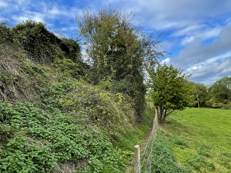
Location: Section of the former town boundary wall with steep bank to E. Runs from the site of the Water Gate,curves SE and continues until the end of the narrow lane which itself follows the course of the town
County: Powys
Community: Hay (Y Gelli Gandryll)
Community: Hay
Built-Up Area: Hay-on-Wye
Traditional County: Brecknockshire
Tagged with: City walls
The wall was probably constructed in C19 out of the town wall which is said to have been largely destroyed by the late C18/early C19. The rubble medieval walls were erected after 1237 financed by a murage tax levied weekly for 3 years by Eva de Breos.
The wall has partially collapsed, is overgrown in several places and is rebuilt at S end to form a garden wall; boarded gate entrance midway along.
Included as a clearly defined and moderately long stretch of medieval town bounary.
External links are from the relevant listing authority and, where applicable, Wikidata. Wikidata IDs may be related buildings as well as this specific building. If you want to add or update a link, you will need to do so by editing the Wikidata entry.


Other nearby listed buildings
