Approximate Location Map
Large Map »
Latitude: 52.0421 / 52°2'31"N
Longitude: -3.1923 / 3°11'32"W
OS Eastings: 318318
OS Northings: 238865
OS Grid: SO183388
Mapcode National: GBR YY.FGSS
Mapcode Global: VH6BH.MX6W
Plus Code: 9C4R2RR5+V3
Entry Name: Outbuilding at Tir Uched
Listing Date: 15 December 1995
Last Amended: 15 December 1995
Grade: II
Source: Cadw
Source ID: 17066
Building Class: Domestic
ID on this website: 300017066
Location: Located on a separate driveway from the main road entrance, to the S of the rear of the house.
County: Powys
Community: Gwernyfed
Community: Gwernyfed
Locality: Treble hill
Traditional County: Brecknockshire
Tagged with: Appendage
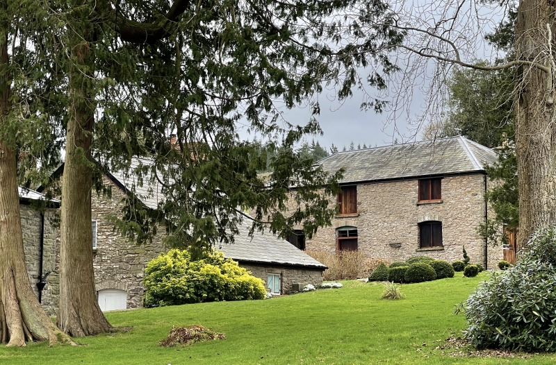
Stable and gig house of c1840, with a large storehouse on the S side, added later.
Whitewashed rubble stone with slate roof. Two storeys, comprising a 1-bay gig house with workshop facing the driveway, and a stable to the rear with hay-loft over. The elevation facing the house is symmetrical with central door and leaded overlight into the stable, and 3-light leaded windows either side, with central iron casement. Roof hipped. Double doors to gig house. Added section cut into bank, with double door facing drive.
Boarded stalling with iron barred upper section divides stable into 2 loose boxes, with service bench under window, and saddle and harness brackets over. High ceiling on 3 transverse beams. Gig house workshop has lateral stone fireplace. Roof has principal rafters morticed into stub ties, pegged to raking struts from the low set collar to the wall. Two tiers of purlins.
Included as of group value with Tir uched house, and as a well-preserved example of the stable-gig house provision for an earlier C19 gentry house.
External links are from the relevant listing authority and, where applicable, Wikidata. Wikidata IDs may be related buildings as well as this specific building. If you want to add or update a link, you will need to do so by editing the Wikidata entry.


Other nearby listed buildings
