Approximate Location Map
Large Map »
Latitude: 52.2591 / 52°15'32"N
Longitude: -3.6588 / 3°39'31"W
OS Eastings: 286876
OS Northings: 263622
OS Grid: SN868636
Mapcode National: GBR 9B.ZV41
Mapcode Global: VH5CT.JHL0
Plus Code: 9C4R785R+JF
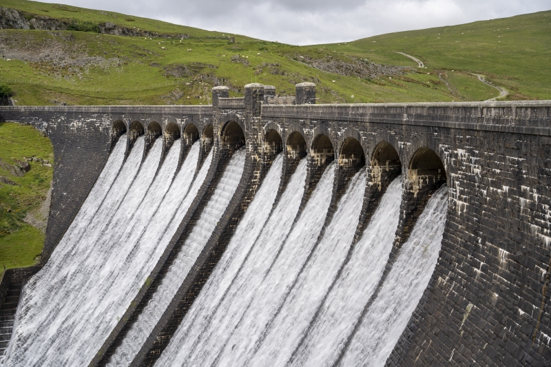
Entry Name: Claerwen dam, including attached footbridges (partly in Rhayader community)
Listing Date: 31 July 1995
Last Amended: 14 November 2000
Grade: II
Source: Cadw
Source ID: 24388
Building Class: Water Supply and Drainage
ID on this website: 300024388
Location: Aproximately 11km SW of Rhayader, reached by Elan Valley road.
County: Powys
Community: Llanwrthwl
Community: Llanwrthwl
Locality: Elan Valley
Traditional County: Brecknockshire
Tagged with: Architectural structure
See Record Number 16222 in Rhayader community for full description of this dam.
External links are from the relevant listing authority and, where applicable, Wikidata. Wikidata IDs may be related buildings as well as this specific building. If you want to add or update a link, you will need to do so by editing the Wikidata entry.


Other nearby listed buildings
