Approximate Location Map
Large Map »
Latitude: 51.7446 / 51°44'40"N
Longitude: -3.3785 / 3°22'42"W
OS Eastings: 304922
OS Northings: 205997
OS Grid: SO049059
Mapcode National: GBR HN.1BWY
Mapcode Global: VH6CY.DD8Y
Plus Code: 9C3RPJVC+RH
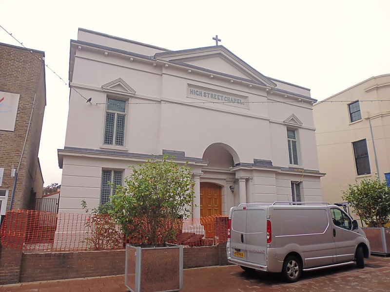
Entry Name: High Street Baptist Church
Listing Date: 22 August 1975
Last Amended: 13 January 1988
Grade: II
Source: Cadw
Source ID: 11451
Building Class: Religious, Ritual and Funerary
Also known as: High Street Baptist Church,High Street
ID on this website: 300011451
Location: On a detached site midway down the pedestrianised section of High Street.
County: Merthyr Tydfil
Community: Town (Y Dref)
Community: Town
Built-Up Area: Merthyr Tydfil
Traditional County: Glamorgan
Tagged with: Church building Chapel
Built 1840.
Bold neo-classical front of 3 bays, painted render with advanced, pedimented centre, parapets to side bays, gable crucifix. Bracket cornice, band course under recessed "High Street Chapel" tablet, deep cornice over banded rusticated ground-floor. Pediments to outer first-floor windows with leaded glazing, plain ground-floor windows. Monumental central entrance with plain arch to later vaulted porch breaking through cornice, detached Doric columns to jambs, twin pilasters flank segmental inner doorway.
One-bay return flanks in similar style, then 4-bay simple walls with plain bands and round headed upper windows with tracery.
Fine 2-storey interior with cast-iron columns supported 3-sided panelled gallery, arcade treatment at gallery level. Great platform with pulpit, big seat etc to inner wall.
External links are from the relevant listing authority and, where applicable, Wikidata. Wikidata IDs may be related buildings as well as this specific building. If you want to add or update a link, you will need to do so by editing the Wikidata entry.


Other nearby listed buildings
