Approximate Location Map
Large Map »
Latitude: 52.8121 / 52°48'43"N
Longitude: -4.6667 / 4°40'0"W
OS Eastings: 220368
OS Northings: 327177
OS Grid: SH203271
Mapcode National: GBR 50.VSZB
Mapcode Global: WH33N.9L00
Plus Code: 9C4QR86M+V8
Entry Name: Barn and Stable Range at Blawdty
Listing Date: 26 June 1998
Last Amended: 26 June 1998
Grade: II
Source: Cadw
Source ID: 20013
Building Class: Agriculture and Subsistence
ID on this website: 300020013
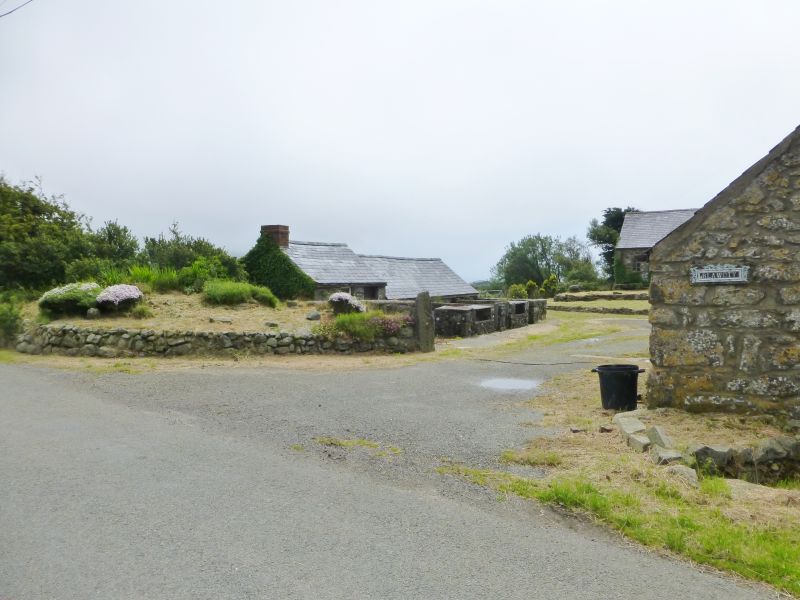
Location: Situated on S side of farmyard at Blawdty, opposite farmhouse.
County: Gwynedd
Town: Pwllheli
Community: Aberdaron
Community: Aberdaron
Locality: Penycaerau
Traditional County: Caernarfonshire
Tagged with: Barn
Range of C19 farmbuildings.
Barn and stable range, rubble stone with slate roof and red tile ridge. Long N front with broad cart-entry to right, with double doors and slate lintel. Window to left with C20 glazing, then door, 2 narrow ventilation loops, then stable with window, door and window, and finally door and window at left end. Windows are small, with top glazing and boarding below, doors are ledged stable doors, the two to left with small rectangular openings over. Slab lintels.
Included as part of the courtyard farmstead group of farmhouse, outbuilding and pigsty at Blawdty.
External links are from the relevant listing authority and, where applicable, Wikidata. Wikidata IDs may be related buildings as well as this specific building. If you want to add or update a link, you will need to do so by editing the Wikidata entry.


Other nearby listed buildings
