Approximate Location Map
Large Map »
Latitude: 51.6601 / 51°39'36"N
Longitude: -1.7926 / 1°47'33"W
OS Eastings: 414444
OS Northings: 195725
OS Grid: SU144957
Mapcode National: GBR 4T2.X6Z
Mapcode Global: VHB30.WJ6P
Plus Code: 9C3WM664+3X
Entry Name: 5, the Street
Listing Date: 20 September 1979
Grade: II
Source: Historic England
Source ID: 1023299
English Heritage Legacy ID: 318261
ID on this website: 101023299
Location: Castle Eaton, Swindon, Wiltshire, SN6
County: Swindon
Civil Parish: Castle Eaton
Traditional County: Wiltshire
Lieutenancy Area (Ceremonial County): Wiltshire
Church of England Parish: Castle Eaton St Mary the Virgin
Church of England Diocese: Gloucester
Tagged with: Building
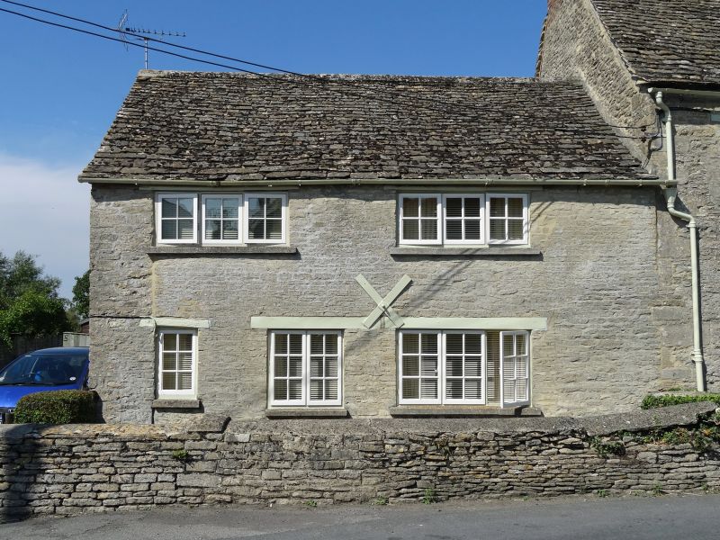
1.
5410 CASTLE EATON THE STREET
(north side)
No 5
SU 1495 19/113
II GV
2.
C18 altered. Low 2 storey cottage built of rubble with stone tile roof. No
chimney visible from front. Wooden lintels. Two 3-light casements on first
floor. Three windows on ground floor, central one replacing door. Door now
in gabled porch to left return. Included mainly for group value.
Listing NGR: SU1444495725
External links are from the relevant listing authority and, where applicable, Wikidata. Wikidata IDs may be related buildings as well as this specific building. If you want to add or update a link, you will need to do so by editing the Wikidata entry.


Other nearby listed buildings
