Approximate Location Map
Large Map »
Latitude: 51.0262 / 51°1'34"N
Longitude: -0.682 / 0°40'55"W
OS Eastings: 492527
OS Northings: 126033
OS Grid: SU925260
Mapcode National: GBR FFX.ND3
Mapcode Global: FRA 96GD.N3N
Plus Code: 9C3X28G9+F5
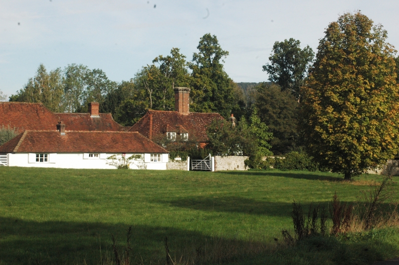
Entry Name: Shotters Farmhouse
Listing Date: 18 June 1959
Grade: II
Source: Historic England
Source ID: 1025885
English Heritage Legacy ID: 301979
ID on this website: 101025885
Location: Lickfold, Chichester, West Sussex, GU28
County: West Sussex
District: Chichester
Civil Parish: Lodsworth
Traditional County: Sussex
Lieutenancy Area (Ceremonial County): West Sussex
Church of England Parish: Lodsworth St Peter
Church of England Diocese: Chichester
Tagged with: Farmhouse
SU 92 NW LODSWORTH LICKFOLD
7/13 Shotters Farmhouse
18.6.59
- II
House. C16 timber-framed building refaced with painted brick on ground floor and
tile-hung above. Hipped tiled roof. Casement windows. Projecting chimney breasts
on north and south walls. Two storeys and attic. Three windows. Two gabled
dormers.
Listing NGR: SU9252726033
External links are from the relevant listing authority and, where applicable, Wikidata. Wikidata IDs may be related buildings as well as this specific building. If you want to add or update a link, you will need to do so by editing the Wikidata entry.


Other nearby listed buildings
