Approximate Location Map
Large Map »
Latitude: 51.412 / 51°24'43"N
Longitude: 0.1332 / 0°7'59"E
OS Eastings: 548447
OS Northings: 170269
OS Grid: TQ484702
Mapcode National: GBR R6.VMH
Mapcode Global: VHHNZ.8R8X
Plus Code: 9F32C46M+R7
Entry Name: Ruxley Farmhouse
Listing Date: 29 June 1973
Grade: II
Source: Historic England
Source ID: 1038317
English Heritage Legacy ID: 358522
ID on this website: 101038317
Location: Upper Ruxley, Bromley, London, DA14
County: London
District: Bromley
Electoral Ward/Division: Cray Valley East
Parish: Non Civil Parish
Traditional County: Kent
Lieutenancy Area (Ceremonial County): Greater London
Church of England Parish: North Cray St James
Church of England Diocese: Rochester
Tagged with: Farmhouse
MAIDSTONE ROAD
1.
4407 ST PAUL'S CRAY
-------------
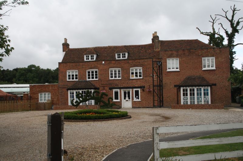
Ruxley Farmhouse
TQ 47 SE 7/102
II
2.
C18. 2 storeys and attic. Red brick. 6 windows. 2 hipped dormers.
Parapet, tiled roof. The south end has a higher elevation than the remainder.
Some exposed timber facing.
Listing NGR: TQ4844770269
External links are from the relevant listing authority and, where applicable, Wikidata. Wikidata IDs may be related buildings as well as this specific building. If you want to add or update a link, you will need to do so by editing the Wikidata entry.


Other nearby listed buildings
