Approximate Location Map
Large Map »
Latitude: 52.8036 / 52°48'12"N
Longitude: -1.6292 / 1°37'45"W
OS Eastings: 425093
OS Northings: 322956
OS Grid: SK250229
Mapcode National: GBR 5DW.8WL
Mapcode Global: WHCG5.YSCK
Plus Code: 9C4WR93C+C8
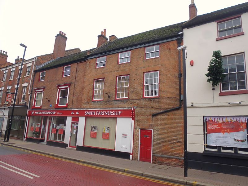
Entry Name: 46, High Street
Listing Date: 22 June 1979
Grade: II
Source: Historic England
Source ID: 1038729
English Heritage Legacy ID: 272962
ID on this website: 101038729
Location: Bond End, East Staffordshire, DE14
County: Staffordshire
District: East Staffordshire
Civil Parish: Burton
Built-Up Area: Burton upon Trent
Traditional County: Staffordshire
Lieutenancy Area (Ceremonial County): Staffordshire
Church of England Parish: Burton-on-Trent All Saints
Church of England Diocese: Lichfield
Tagged with: Building
HIGH STREET
1. (West Side)
5369
No 46
SK 2522 NW 3/61
II
2.
Mid C18 exterior to probable earlier core. Red brick; 3 storeys; 3 sash windows
with flat brick arches; plain wood eaves; old tiles. Plain doorway on right-hand
side; late C19 shop front with modern glazing.
Listing NGR: SK2509322956
External links are from the relevant listing authority and, where applicable, Wikidata. Wikidata IDs may be related buildings as well as this specific building. If you want to add or update a link, you will need to do so by editing the Wikidata entry.


Other nearby listed buildings
