Approximate Location Map
Large Map »
Latitude: 51.5372 / 51°32'13"N
Longitude: -0.9011 / 0°54'3"W
OS Eastings: 476312
OS Northings: 182606
OS Grid: SU763826
Mapcode National: GBR C4S.F11
Mapcode Global: VHDWG.BMGF
Plus Code: 9C3XG3PX+VH
Entry Name: Railings at Rectory
Listing Date: 28 October 1974
Grade: II
Source: Historic England
Source ID: 1047729
English Heritage Legacy ID: 246335
ID on this website: 101047729
Location: Henley-on-Thames, South Oxfordshire, RG9
County: Oxfordshire
District: South Oxfordshire
Civil Parish: Henley-on-Thames
Built-Up Area: Henley-on-Thames
Traditional County: Oxfordshire
Lieutenancy Area (Ceremonial County): Oxfordshire
Church of England Parish: Henley-on-Thames
Church of England Diocese: Oxford
Tagged with: Guard rail
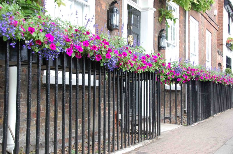
1. THAMESIDE
5355 (West Side)
Railings at No 17 (Rectory)
SU 7582 1/388
II GV
2.
C18 iron railings along street boundary, continuous with those of the
Coach House (q.v.).
Nos 16 and 17 form a group with their railings.
Listing NGR: SU7630382606
External links are from the relevant listing authority and, where applicable, Wikidata. Wikidata IDs may be related buildings as well as this specific building. If you want to add or update a link, you will need to do so by editing the Wikidata entry.


Other nearby listed buildings
