History in Structure

Boundary Wall Approximately 30 Metres West of Manor Farmhouse

A Grade II Listed Building in South Stoke, Oxfordshire

« Listing Details
Upload Photo

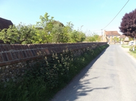
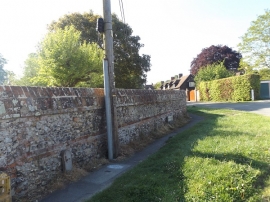
Entry Name: Boundary Wall Approximately 30 Metres West of Manor Farmhouse

Listing Date: 13 January 1986

Grade: II

Source: Historic England

Source ID: 1059269

English Heritage Legacy ID: 248025

ID on this website: 101059269

Location: South Stoke, South Oxfordshire, RG8

County: Oxfordshire

District: South Oxfordshire

Civil Parish: South Stoke

Built-Up Area: South Stoke

Traditional County: Oxfordshire

Lieutenancy Area (Ceremonial County): Oxfordshire

Church of England Parish: South Stoke

Church of England Diocese: Oxford

BritishListedBuildings.co.uk is an independent online resource and is not associated with any government department. All government data published here is used under licence. Please do not contact BritishListedBuildings.co.uk for any queries related to any individual listed building, planning permission related to listed buildings or the listing process itself.

British Listed Buildings is a Good Stuff website.