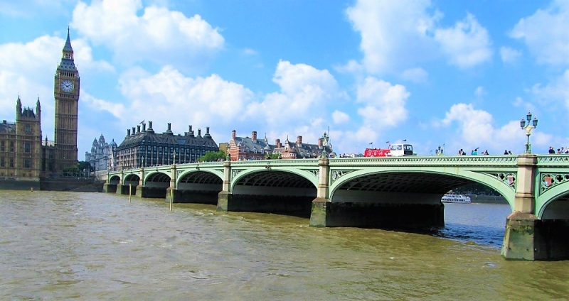
Latitude: 51.5009 / 51°30'3"N
Longitude: -0.1217 / 0°7'18"W
OS Eastings: 530468
OS Northings: 179663
OS Grid: TQ304796
Mapcode National: GBR JJ.T5
Mapcode Global: VHGQZ.VJ0S
Plus Code: 9C3XGV2H+88
Entry Name: Westminster Bridge
Listing Date: 5 February 1970
Grade: II*
Source: Historic England
Source ID: 1066172
English Heritage Legacy ID: 207389
ID on this website: 101066172
Location: City of Westminster, Lambeth, London, SE1
County: London
District: Lambeth
Electoral Ward/Division: St James's
Parish: Non Civil Parish
Built-Up Area: City of Westminster
Traditional County: Surrey
Lieutenancy Area (Ceremonial County): Greater London
Church of England Parish: Waterloo St John with St Andrew
Church of England Diocese: Southwark
TQ 3079 NW CITY OF WESTMINSTER VICTORIA EMBANKMENT SW1
92/43
Westminster Bridge
5.2.70
GV II*
Road bridge. 1862, by Thomas Page. Cast iron with piers and abutments of
grey granite. Gothic detailing in keeping with Houses of Parliament. 7
segmental girder arches, cast iron pierced work panelled spandrels with
shields and Gothic pierced work balustrades to parapets with the dies surmounted
by Tudor-Gothic cast iron lampstandards with twin bracketed octagonal lanterns
and crowning lantern - all with gilded finials. Eastern half in London Borough
of Lambeth.
Listing NGR: TQ3046879663


Other nearby listed buildings