Approximate Location Map
Large Map »
Latitude: 51.5185 / 51°31'6"N
Longitude: -0.1613 / 0°9'40"W
OS Eastings: 527670
OS Northings: 181556
OS Grid: TQ276815
Mapcode National: GBR 79.YT
Mapcode Global: VHGQZ.5327
Plus Code: 9C3XGR9Q+CF
Entry Name: Water Pump at North End of Central Garden
Listing Date: 1 December 1987
Grade: II
Source: Historic England
Source ID: 1066357
English Heritage Legacy ID: 208885
ID on this website: 101066357
Location: Marylebone, Westminster, London, W1H
County: London
District: City of Westminster
Electoral Ward/Division: Bryanston and Dorset Square
Parish: Non Civil Parish
Built-Up Area: City of Westminster
Traditional County: Middlesex
Lieutenancy Area (Ceremonial County): Greater London
Church of England Parish: St Mary Bryanston Square
Church of England Diocese: London
Tagged with: Well
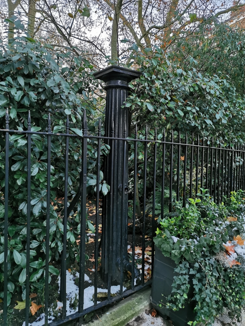
TQ 2781 NE CITY OF WESTMINSTER BRYANSTON SQUARE W1
43/118 Water pump at north end of
central garden
II
Water pump. Early C19. Cast iron. In form of Doric column.
Listing NGR: TQ2767081556
External links are from the relevant listing authority and, where applicable, Wikidata. Wikidata IDs may be related buildings as well as this specific building. If you want to add or update a link, you will need to do so by editing the Wikidata entry.


Other nearby listed buildings
