Approximate Location Map
Large Map »
Latitude: 51.4918 / 51°29'30"N
Longitude: -0.1768 / 0°10'36"W
OS Eastings: 526672
OS Northings: 178556
OS Grid: TQ266785
Mapcode National: GBR 4M.HD
Mapcode Global: VHGQY.WRDS
Plus Code: 9C3XFRRF+P7
Entry Name: Entrance Arch from Cranley Place
Listing Date: 6 August 1973
Grade: II
Source: Historic England
Source ID: 1066582
English Heritage Legacy ID: 422370
ID on this website: 101066582
Location: South Kensington, Kensington and Chelsea, London, SW7
County: London
District: Kensington and Chelsea
Electoral Ward/Division: Courtfield
Parish: Non Civil Parish
Built-Up Area: Kensington and Chelsea
Traditional County: Middlesex
Lieutenancy Area (Ceremonial County): Greater London
Church of England Parish: Holy Trinity with St Paul, Onslow Sq and St Augustine, Sth Kensington
Church of England Diocese: London
Tagged with: Building
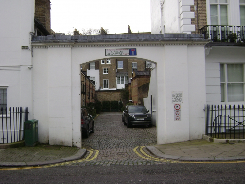
TQ 2678 NE ONSLOW MEWS WEST SW7
47/22
6.8.73 Entrance Arch from Cranley
Place
II
Circa 1865. Plain segmental headed stucco arch with dentil cornice over.
Listing NGR: TQ2667278556
External links are from the relevant listing authority and, where applicable, Wikidata. Wikidata IDs may be related buildings as well as this specific building. If you want to add or update a link, you will need to do so by editing the Wikidata entry.


Other nearby listed buildings
