Approximate Location Map
Large Map »
Latitude: 51.3169 / 51°19'0"N
Longitude: 0.8856 / 0°53'8"E
OS Eastings: 601185
OS Northings: 161481
OS Grid: TR011614
Mapcode National: GBR SW3.8QZ
Mapcode Global: VHKJW.95KB
Plus Code: 9F328V8P+P7
Entry Name: 65, West Street
Listing Date: 4 May 1970
Grade: II
Source: Historic England
Source ID: 1067600
English Heritage Legacy ID: 438546
ID on this website: 101067600
Location: Davington, Swale, Kent, ME13
County: Kent
District: Swale
Civil Parish: Faversham
Built-Up Area: Faversham
Traditional County: Kent
Lieutenancy Area (Ceremonial County): Kent
Tagged with: Building
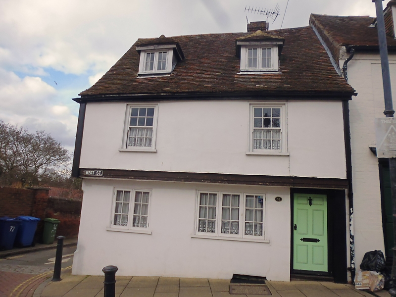
WEST STREET
1.
1103 (North Side)
------------
No 65
TR 0161 SW 2/123 4.5.70.
II
2.
C17 timber-framed house, refronted in the Cl9 but retaining the overhang of
its 1st floor on a bressummer. 2 storeys. 2 windows. Plastered.
Tiled roof. Modern casement windows.
Listing NGR: TR0118761482
External links are from the relevant listing authority and, where applicable, Wikidata. Wikidata IDs may be related buildings as well as this specific building. If you want to add or update a link, you will need to do so by editing the Wikidata entry.


Other nearby listed buildings
