Approximate Location Map
Large Map »
Latitude: 51.9418 / 51°56'30"N
Longitude: -2.9811 / 2°58'51"W
OS Eastings: 332654
OS Northings: 227492
OS Grid: SO326274
Mapcode National: GBR F7.MTBN
Mapcode Global: VH78N.8GV7
Plus Code: 9C3VW2R9+PH
Entry Name: Sundial Approximately 7 Metres South of Church of St Clodock
Listing Date: 14 March 1986
Grade: II
Source: Historic England
Source ID: 1067734
English Heritage Legacy ID: 355387
ID on this website: 101067734
Location: St Clydog's Church, Clodock, County of Herefordshire, HR2
County: County of Herefordshire
Civil Parish: Longtown
Traditional County: Herefordshire
Lieutenancy Area (Ceremonial County): Herefordshire
Church of England Parish: Clodock and Longtown
Church of England Diocese: Hereford
Tagged with: Sundial
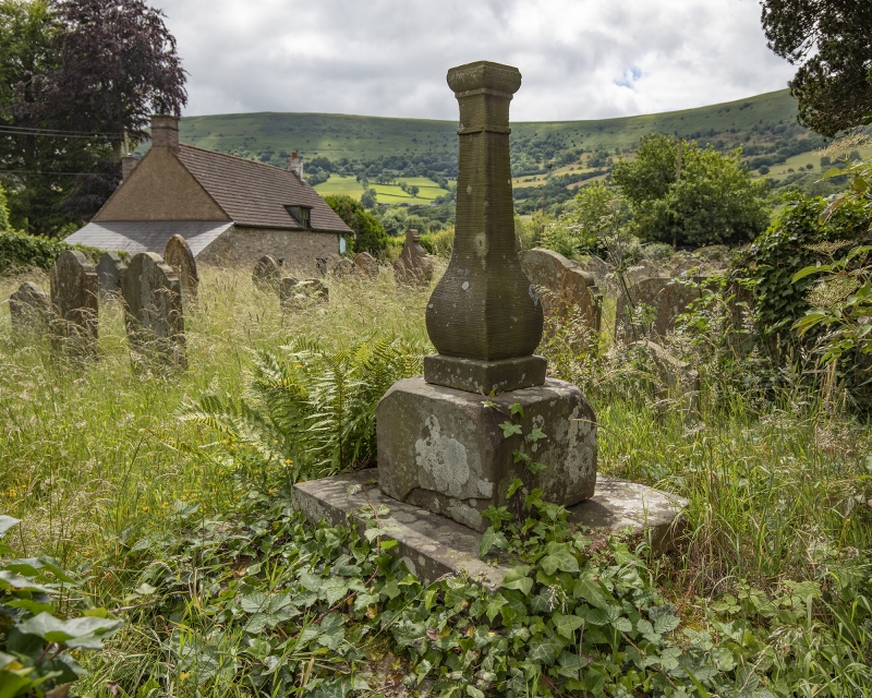
SO 32 NW LONGTOWN CP CLODOCK
6/78 Sundial approximately 7 m
south of Church of St
Clodock
GV II
Sundial. C18. Sandstone ashlar. Stepped plinth, square base with baluster-
shaped shaft; sundial inset missing.
Listing NGR: SO3265427492
External links are from the relevant listing authority and, where applicable, Wikidata. Wikidata IDs may be related buildings as well as this specific building. If you want to add or update a link, you will need to do so by editing the Wikidata entry.


Other nearby listed buildings
