Approximate Location Map
Large Map »
Latitude: 51.498 / 51°29'52"N
Longitude: -0.2575 / 0°15'27"W
OS Eastings: 521052
OS Northings: 179112
OS Grid: TQ210791
Mapcode National: GBR 8S.CRT
Mapcode Global: VHGQX.HM70
Plus Code: 9C3XFPXV+52
Entry Name: 9 and 11, Queen Anne's Grove
Listing Date: 2 February 1970
Grade: II
Source: Historic England
Source ID: 1079368
English Heritage Legacy ID: 201014
ID on this website: 101079368
Location: Bedford Park, Ealing, London, W4
County: London
District: Ealing
Electoral Ward/Division: Southfield
Parish: Non Civil Parish
Built-Up Area: Ealing
Traditional County: Middlesex
Lieutenancy Area (Ceremonial County): Greater London
Church of England Parish: St Michael and All Angels Bedford Park
Church of England Diocese: London
Tagged with: Building
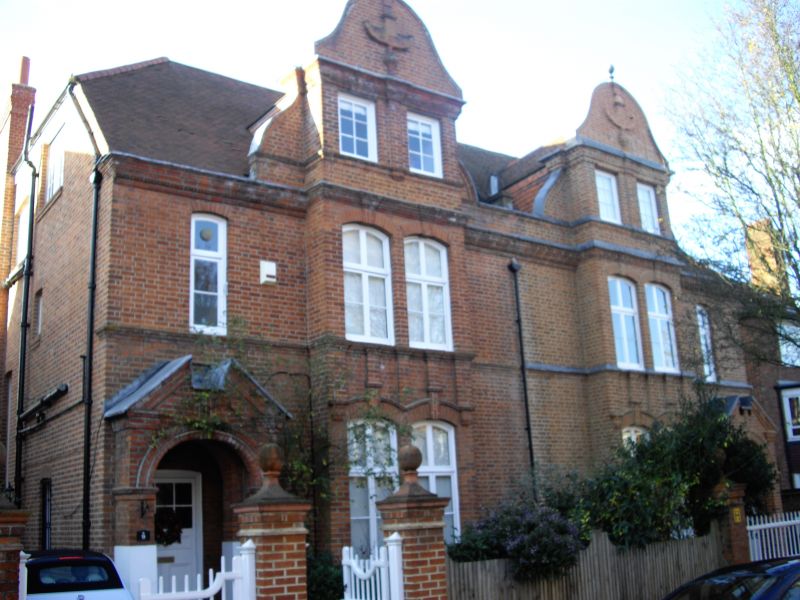
QUEEN ANNE'S GROVE
1.
5010
(west side)
Nos 9 and 11
TQ 2179 7/31 2.2.70
II GV
2.
Circa 1880. By R N Shaw, a variant on the third semi-detached design. Red
brick with some enrichment, tiled roofs. Two storeys and attics. Dutch gables.
Arched entrances with broken pediments.
Listing NGR: TQ2105279112
External links are from the relevant listing authority and, where applicable, Wikidata. Wikidata IDs may be related buildings as well as this specific building. If you want to add or update a link, you will need to do so by editing the Wikidata entry.


Other nearby listed buildings
