Latitude: 54.118 / 54°7'4"N
Longitude: -0.0896 / 0°5'22"W
OS Eastings: 524966
OS Northings: 470810
OS Grid: TA249708
Mapcode National: GBR WNTT.DK
Mapcode Global: WHHF2.LRKG
Plus Code: 9C6X4W96+55
Entry Name: The Old Lighthouse
Listing Date: 11 January 1952
Last Amended: 2 January 1985
Grade: II*
Source: Historic England
Source ID: 1083400
English Heritage Legacy ID: 166822
Also known as: The old lighthouse, Flamborough
Chalk Tower, Flamborough
ID on this website: 101083400
Location: East Riding of Yorkshire, YO15
County: East Riding of Yorkshire
Civil Parish: Flamborough
Traditional County: Yorkshire
Lieutenancy Area (Ceremonial County): East Riding of Yorkshire
Church of England Parish: Flamborough St Oswald
Church of England Diocese: York
Tagged with: Lighthouse
TA 27 SW FLAMBOROUGH LIGHTHOUSE ROAD (north side)
7/46 The Old Lighthouse (Formerly listed as 11.1.52 Beacon Tower) - II*
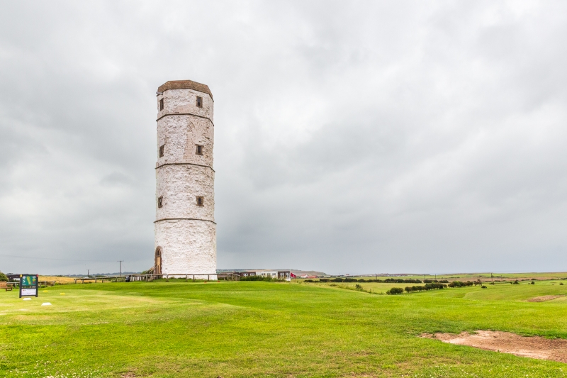
Former lighthouse, 1674. Coursed chalk rubble with stone dressings; later repairs in red and light brown brick. Octagonal tower of 4 stages and brick parapet, all marked by moulded string-courses. Boarded door in pointed red brick surround; blocked door in pointed yellow brick to landward side. Rectangular windows to upper 3 stages on seaward facing cardinal sides: stone surrounds with plain chamfers to reveals, sills, and lintels. Low roof behind parapet. Interior contains C20 wooden stairs and floors. This lighthouse, established as a business venture by Sir John Clayton, was never used.
Listing NGR: TA2496670810
External links are from the relevant listing authority and, where applicable, Wikidata. Wikidata IDs may be related buildings as well as this specific building. If you want to add or update a link, you will need to do so by editing the Wikidata entry.


Other nearby listed buildings