Approximate Location Map
Large Map »
Latitude: 51.05 / 51°2'59"N
Longitude: 0.6302 / 0°37'48"E
OS Eastings: 584450
OS Northings: 131137
OS Grid: TQ844311
Mapcode National: GBR QWD.44Y
Mapcode Global: FRA D66B.WW4
Plus Code: 9F322JXJ+X3
Entry Name: The Old Parsonage
Listing Date: 16 August 1962
Grade: II
Source: Historic England
Source ID: 1115726
English Heritage Legacy ID: 180325
ID on this website: 101115726
Location: Rolvenden, Ashford, Kent, TN17
County: Kent
District: Ashford
Civil Parish: Rolvenden
Built-Up Area: Rolvenden
Traditional County: Kent
Lieutenancy Area (Ceremonial County): Kent
Tagged with: Clergy house
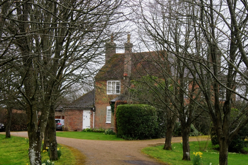
ROLVENDEN HASTINGS ROAD
1.
5272
(north-east side)
No 24
(The Old Parsonage)
TQ 8431 18/284 16.8.62.
II GV
2.
C18. Two storeys. Ground floor red brick, above tile hung. Hipped tiled
rcof. Three sashes with glazing bars intact and another window bay on the
ground floor to the north. Doorcase is moulded architrave surround with flat
hood over, rectangular fanlight and door of 6 fielded panels.
Listing NGR: TQ8445031137
External links are from the relevant listing authority and, where applicable, Wikidata. Wikidata IDs may be related buildings as well as this specific building. If you want to add or update a link, you will need to do so by editing the Wikidata entry.


Other nearby listed buildings
