Approximate Location Map
Large Map »
Latitude: 52.431 / 52°25'51"N
Longitude: 0.2506 / 0°15'2"E
OS Eastings: 553105
OS Northings: 283830
OS Grid: TL531838
Mapcode National: GBR M62.J5D
Mapcode Global: VHHJ6.95B6
Plus Code: 9F42C7J2+C6
Entry Name: Tower Mill
Listing Date: 26 February 1985
Grade: II
Source: Historic England
Source ID: 1127017
English Heritage Legacy ID: 49454
ID on this website: 101127017
Location: Little Downham, East Cambridgeshire, CB6
County: Cambridgeshire
District: East Cambridgeshire
Civil Parish: Downham
Traditional County: Cambridgeshire
Lieutenancy Area (Ceremonial County): Cambridgeshire
Church of England Parish: Downham
Church of England Diocese: Ely
Tagged with: Mill
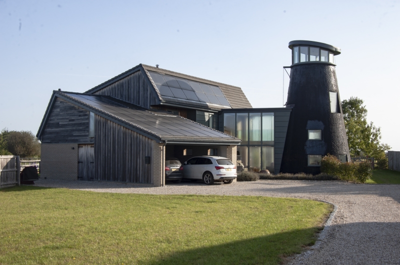
TL 58 SW DOWNHAM ELY ROAD
4/1 Tower Mill
II
Tower mill. Early to mid C19. Tarred gault brick. Three storeys with no
internal surviving features. Window openings without frames.
Listing NGR: TL5310583830
External links are from the relevant listing authority and, where applicable, Wikidata. Wikidata IDs may be related buildings as well as this specific building. If you want to add or update a link, you will need to do so by editing the Wikidata entry.


Other nearby listed buildings
