Approximate Location Map
Large Map »
Latitude: 51.5383 / 51°32'17"N
Longitude: -2.3984 / 2°23'54"W
OS Eastings: 372467
OS Northings: 182225
OS Grid: ST724822
Mapcode National: GBR JZ.GCDR
Mapcode Global: VH95T.CLYM
Plus Code: 9C3VGJQ2+8M
Entry Name: 2, Rounceval Street
Listing Date: 29 July 1983
Grade: II
Source: Historic England
Source ID: 1129295
English Heritage Legacy ID: 34182
ID on this website: 101129295
Location: Chipping Sodbury, South Gloucestershire, BS37
County: South Gloucestershire
Civil Parish: Sodbury
Built-Up Area: Chipping Sodbury
Traditional County: Gloucestershire
Lieutenancy Area (Ceremonial County): Gloucestershire
Church of England Parish: Chipping Sodbury St John the Baptist
Church of England Diocese: Gloucester
Tagged with: Building
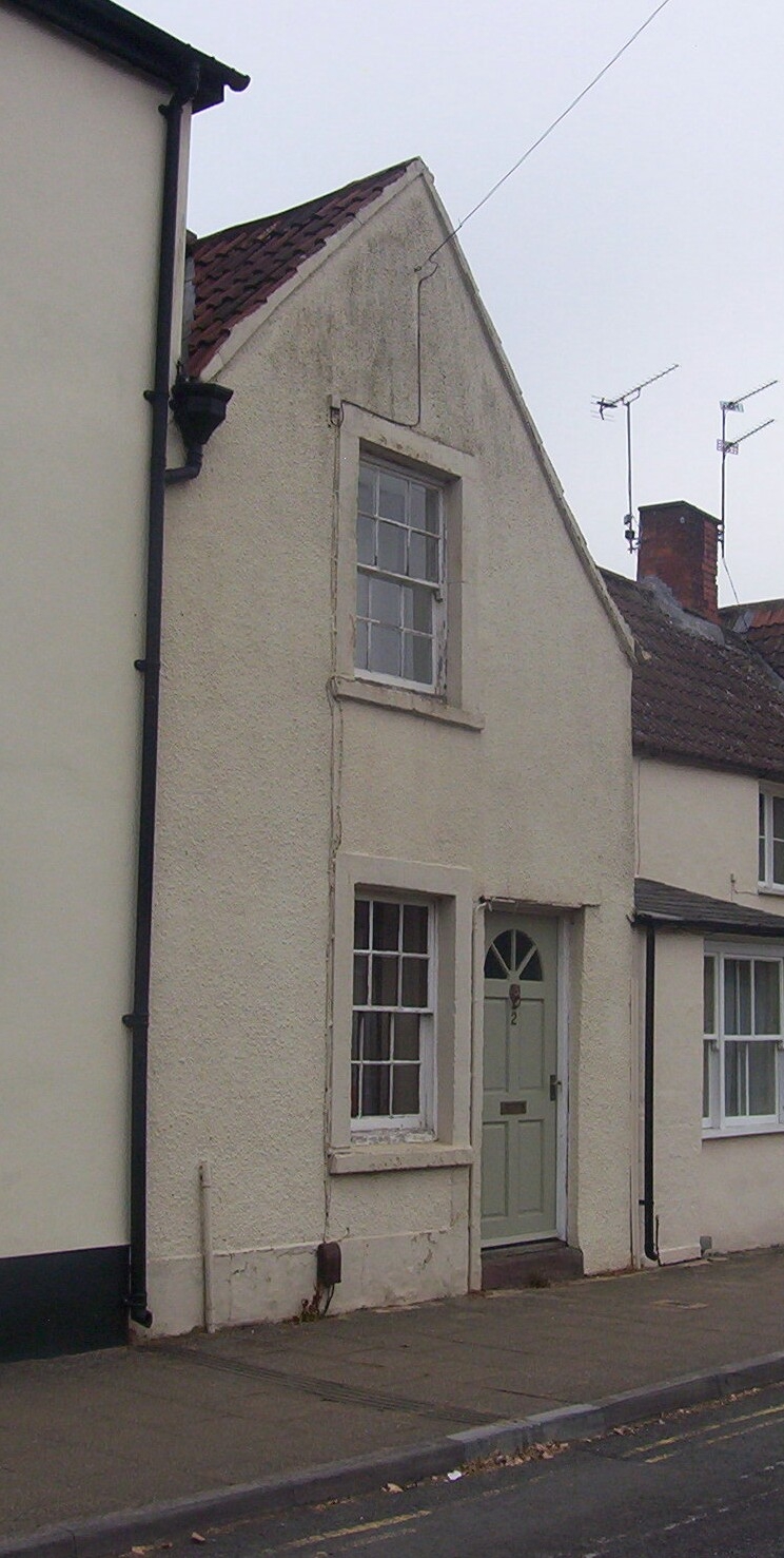
ST 7282 SW SODBURY ROUNCEVAL STREET
4/132 (north side)
THE PARADE
No 2
GV
II
C17; altered late C18. Rendered, Double Roman tile roof. One storey and attic. One
window; glazing bar sashes with flat painted stone surrounds. Panelled door.
Listing NGR: ST7246782225
External links are from the relevant listing authority and, where applicable, Wikidata. Wikidata IDs may be related buildings as well as this specific building. If you want to add or update a link, you will need to do so by editing the Wikidata entry.


Other nearby listed buildings
