Approximate Location Map
Large Map »
Latitude: 51.6377 / 51°38'15"N
Longitude: -0.787 / 0°47'13"W
OS Eastings: 484041
OS Northings: 193903
OS Grid: SU840939
Mapcode National: GBR D52.CTP
Mapcode Global: VHDW4.93TD
Plus Code: 9C3XJ6Q7+36
Entry Name: Gatepiers to Park Farm Adjoining Round House
Listing Date: 28 June 1973
Grade: II
Source: Historic England
Source ID: 1160508
English Heritage Legacy ID: 46151
ID on this website: 101160508
Location: Sands, Buckinghamshire, HP12
County: Buckinghamshire
Civil Parish: West Wycombe
Traditional County: Buckinghamshire
Lieutenancy Area (Ceremonial County): Buckinghamshire
Church of England Parish: West Wycombe
Church of England Diocese: Oxford
Tagged with: Gatepost
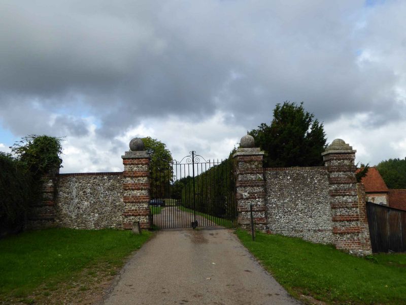
WEST WYCOMBE
1.
963
Gate Piers to
Park Farm adjoining
Round House
SU 8493 10/350
II
2.
Late C18. Flint rubble with red brick bands. 4 piers, with ashlar copings
and blocking courses, outer piers joined to inner by flint rubble walls
with red brick copings.
Listing NGR: SU8404193903
External links are from the relevant listing authority and, where applicable, Wikidata. Wikidata IDs may be related buildings as well as this specific building. If you want to add or update a link, you will need to do so by editing the Wikidata entry.


Other nearby listed buildings
