Approximate Location Map
Large Map »
Latitude: 51.419 / 51°25'8"N
Longitude: -1.5097 / 1°30'34"W
OS Eastings: 434189
OS Northings: 169004
OS Grid: SU341690
Mapcode National: GBR 700.WNH
Mapcode Global: VHC1S.SL7J
Plus Code: 9C3WCF9R+J4
Entry Name: Bridge over River Kennet
Listing Date: 8 June 1984
Grade: II
Source: Historic England
Source ID: 1210246
English Heritage Legacy ID: 394888
ID on this website: 101210246
Location: Eddington, West Berkshire, RG17
County: West Berkshire
Civil Parish: Hungerford
Traditional County: Berkshire
Lieutenancy Area (Ceremonial County): Berkshire
Church of England Parish: Hungerford with Denford
Church of England Diocese: Oxford
Tagged with: Bridge
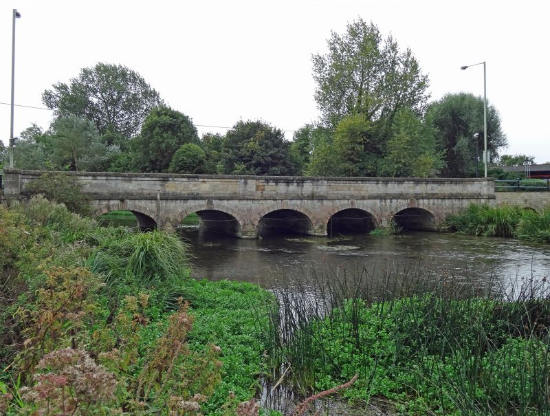
HUNGERFORD BATH ROAD, EDDINGTON
SU 36 NW
11/19 Bridge over River Kennet
II
Bridge. 1827. Stone Ashlar. 5 arches, plain parapet with chamfered
capping and panel over centre arch; square end piers, flat band at road
level and chanelled voussoirs with extended keystones to arches springing
off cutwaters.
Listing NGR: SU3418969004
External links are from the relevant listing authority and, where applicable, Wikidata. Wikidata IDs may be related buildings as well as this specific building. If you want to add or update a link, you will need to do so by editing the Wikidata entry.


Other nearby listed buildings
