Approximate Location Map
Large Map »
Latitude: 51.4873 / 51°29'14"N
Longitude: -0.6088 / 0°36'31"W
OS Eastings: 496692
OS Northings: 177402
OS Grid: SU966774
Mapcode National: GBR F8D.NX2
Mapcode Global: VHFT8.DWJ6
Plus Code: 9C3XF9PR+WF
Entry Name: 50, High Street
Listing Date: 14 May 1973
Grade: II
Source: Historic England
Source ID: 1211364
English Heritage Legacy ID: 395839
ID on this website: 101211364
Location: Eton, Windsor and Maidenhead, Berkshire, SL4
County: Windsor and Maidenhead
Civil Parish: Eton
Built-Up Area: Eton
Traditional County: Buckinghamshire
Lieutenancy Area (Ceremonial County): Berkshire
Church of England Parish: Eton
Church of England Diocese: Oxford
Tagged with: Building
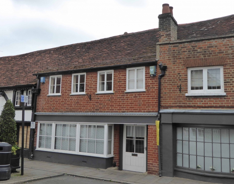
1. HIGH STREET
1909 (East Side)
No 50
SU 9677 SE 2/87
II GV
2.
Modern front to early building. Roof, continued from The Cock Pitt, of old tiles.
2 storeys; stucco ground floor, timber faced beam, red brick first floor with 4
casements. Included for group value.
Nos 47 to 52 (consec) and No 52A form a group.
Listing NGR: SU9669277402
External links are from the relevant listing authority and, where applicable, Wikidata. Wikidata IDs may be related buildings as well as this specific building. If you want to add or update a link, you will need to do so by editing the Wikidata entry.


Other nearby listed buildings
