Approximate Location Map
Large Map »
Latitude: 50.7353 / 50°44'6"N
Longitude: -2.7638 / 2°45'49"W
OS Eastings: 346193
OS Northings: 93127
OS Grid: SY461931
Mapcode National: GBR PP.03J7
Mapcode Global: FRA 5734.F2Q
Plus Code: 9C2VP6PP+4F
Entry Name: 10 and 12, North Allington
Listing Date: 1 July 1975
Grade: II
Source: Historic England
Source ID: 1216321
English Heritage Legacy ID: 401661
ID on this website: 101216321
Location: Allington, Dorset, DT6
County: Dorset
Civil Parish: Bridport
Built-Up Area: Bridport
Traditional County: Dorset
Lieutenancy Area (Ceremonial County): Dorset
Church of England Parish: Bridport St Mary
Church of England Diocese: Salisbury
Tagged with: Building
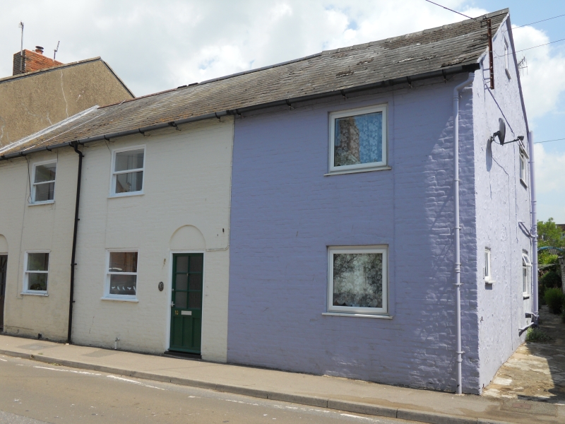
1.
5191 NORTH ALLINGTON
(East Side)
1.7.75. Nos 10 and 12
SY 4693 2/311
II
2.
Late C18. Red brick. Pitched slate roof. Red brick stacks. 2 storeys.
3 ranges of casements with glazing bars. 2 doors (No l0's contemporary) with
blind semi-circular fanlight.
Listing NGR: SY4619693125
External links are from the relevant listing authority and, where applicable, Wikidata. Wikidata IDs may be related buildings as well as this specific building. If you want to add or update a link, you will need to do so by editing the Wikidata entry.


Other nearby listed buildings
