Approximate Location Map
Large Map »
Latitude: 53.3366 / 53°20'11"N
Longitude: -2.8734 / 2°52'24"W
OS Eastings: 341941
OS Northings: 382543
OS Grid: SJ419825
Mapcode National: GBR 8YCV.QM
Mapcode Global: WH87N.TDXF
Plus Code: 9C5V84PG+JM
Entry Name: Bridge over Moat to East of Speke Hall
Listing Date: 14 March 1975
Last Amended: 19 June 1985
Grade: II
Source: Historic England
Source ID: 1217905
English Heritage Legacy ID: 359550
ID on this website: 101217905
Location: Liverpool, Merseyside, L24
County: Liverpool
Electoral Ward/Division: Speke-Garston
Parish: Non Civil Parish
Built-Up Area: Liverpool
Traditional County: Lancashire
Lieutenancy Area (Ceremonial County): Merseyside
Church of England Parish: Speke St Aidan
Church of England Diocese: Liverpool
Tagged with: Bridge
SJ 48 SW SPEKE HALL ROAD
L24
10/1176 Bridge over moat
to east of Speke
Hall (formerly
listed with
bridge over moat
to north of
Speke Hall).
14.3.75.
G.V. II
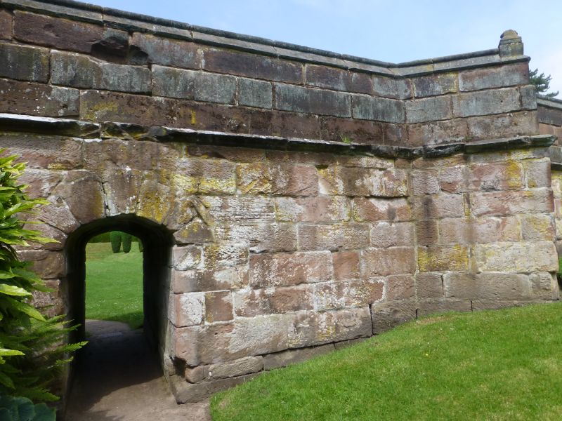
Bridge over moat. Date uncertain. Stone.
Listing NGR: SJ4194182543
External links are from the relevant listing authority and, where applicable, Wikidata. Wikidata IDs may be related buildings as well as this specific building. If you want to add or update a link, you will need to do so by editing the Wikidata entry.


Other nearby listed buildings
